Seascape Alaska 5: Gulf of Alaska Remotely Operated Vehicle Exploration and Mapping
(EX2306)
August 23 - September 14, 2023
NOAA Ship Okeanos Explorer
Gulf of Alaska
Map, explore, and characterize ecologically and economically important deepwater habitats in unexplored regions off Alaska
Multibeam sonar, remotely operated vehicles Deep Discoverer and Seirios
Expedition Summary
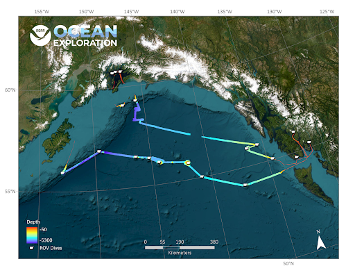
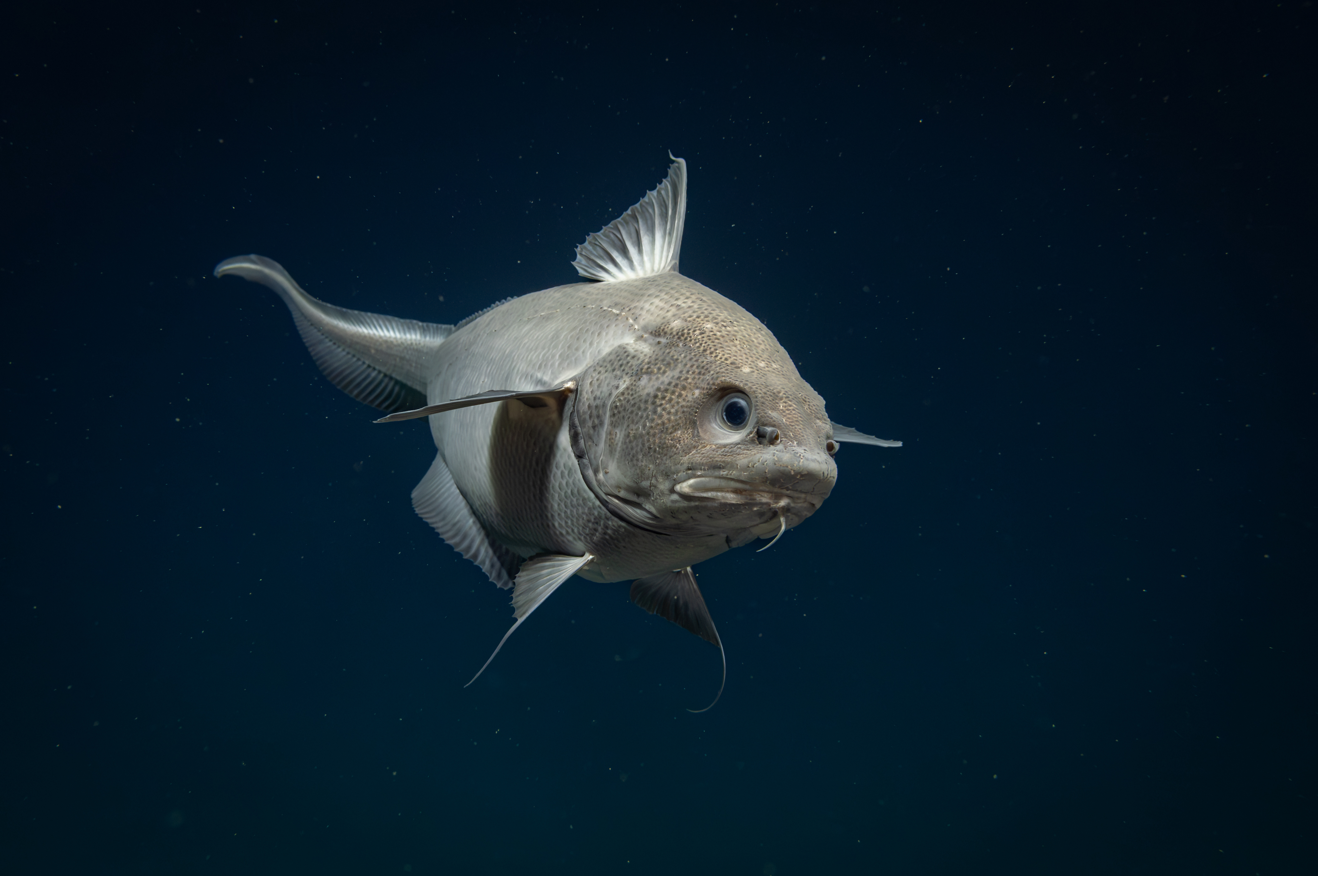
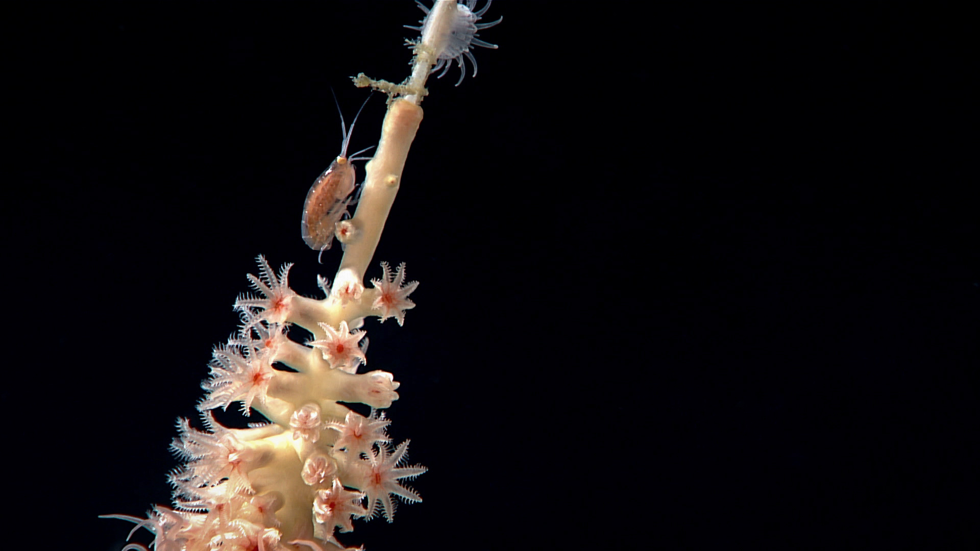
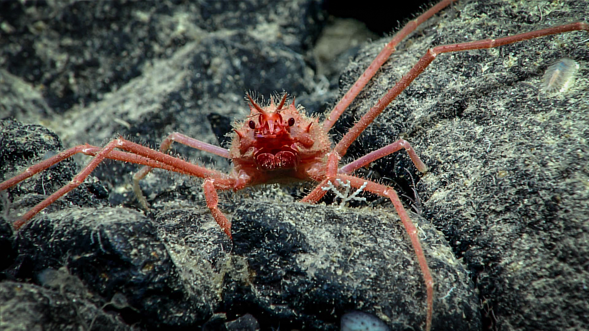
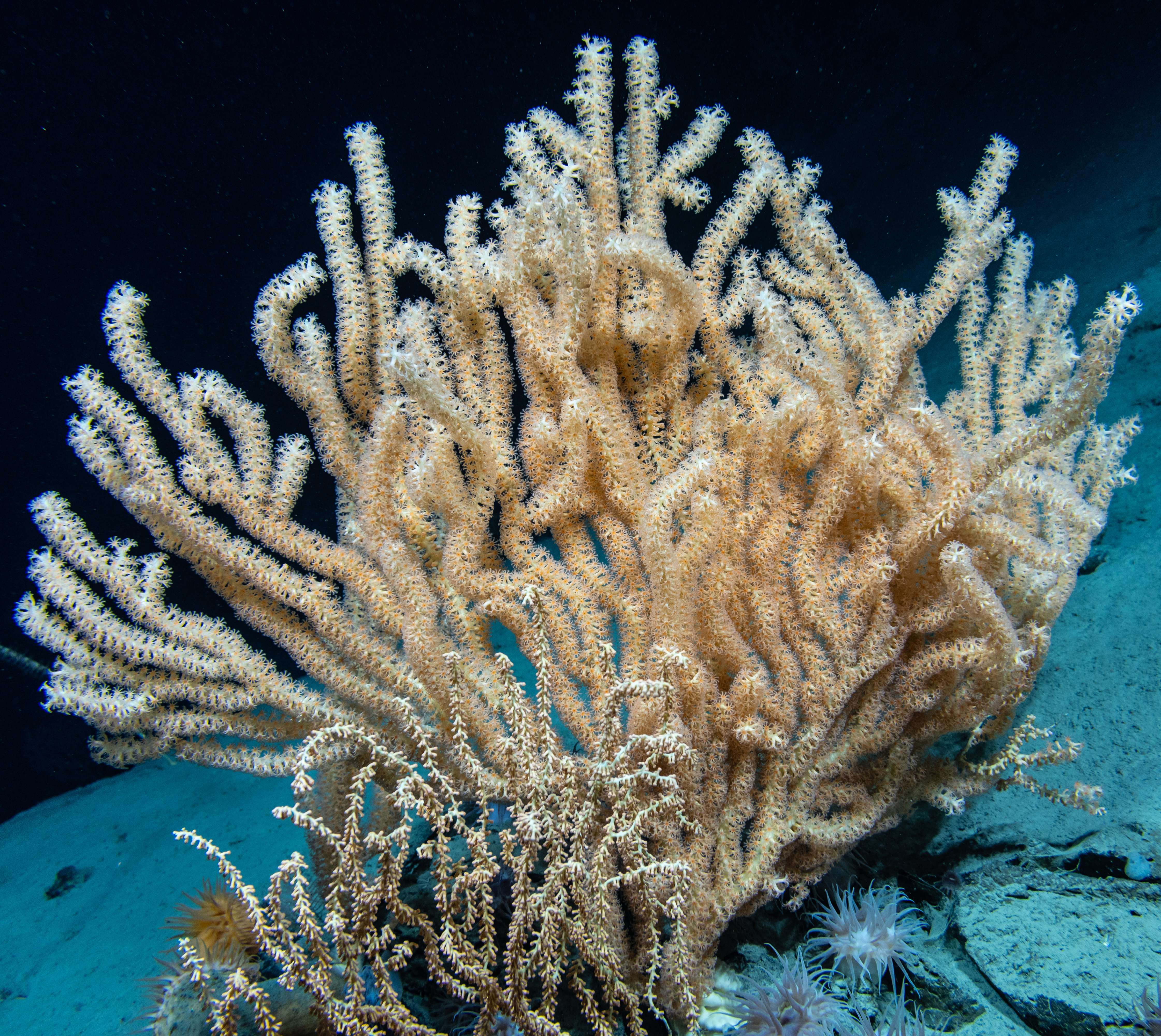
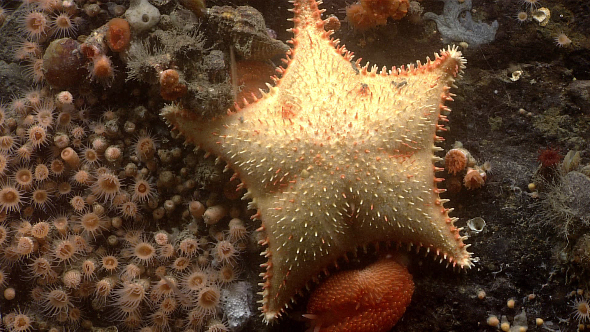
From August 23 - September 14, NOAA Ocean Exploration and partners conducted the fifth in a series of Seascape Alaska expeditions on NOAA Ship Okeanos Explorer. Operations during this 23-day expedition included 19 successful remotely operated vehicle (ROV) dives conducted in water depths ranging from 253 - 4,262 meters (830 - 13,983 feet), mapping of 28,287 square kilometers (10,922 square miles) of seafloor, and the collection of a wide variety of biological and geological samples. Altogether, data from the Seascape Alaska 5: Gulf of Alaska Remotely Operated Vehicle Exploration and Mapping expedition will contribute to our collective baseline understanding of the ocean, improving our ability to protect and manage marine ecosystems and furthering public awareness of the splendor, importance, and interconnectivity of the ocean to our everyday lives. View full expedition summary.
During the Seascape Alaska 5 expedition, the team navigated challenges ranging from rough weather to poor visibility, and completed 19 deepwater remotely operated vehicles (ROV) dives in the Gulf of Alaska and coastal fjords.
Operational Summary
- Days at sea: 23
- Full ROV dives: 19, ranging in depth from 253 - 4,262 meters (830 - 13,983 feet)
- Biological samples collected: 72 primary samples, 197 associates
- Geological samples collected: 32 primary samples, 13 associates
- Water samples collected for eDNA analysis: 70
- Seafloor area mapped: nearly 28,287 square kilometers (10,922 square miles)
- Science party participants: >50
- Live video views: Approximately 222,000
Images and Videos

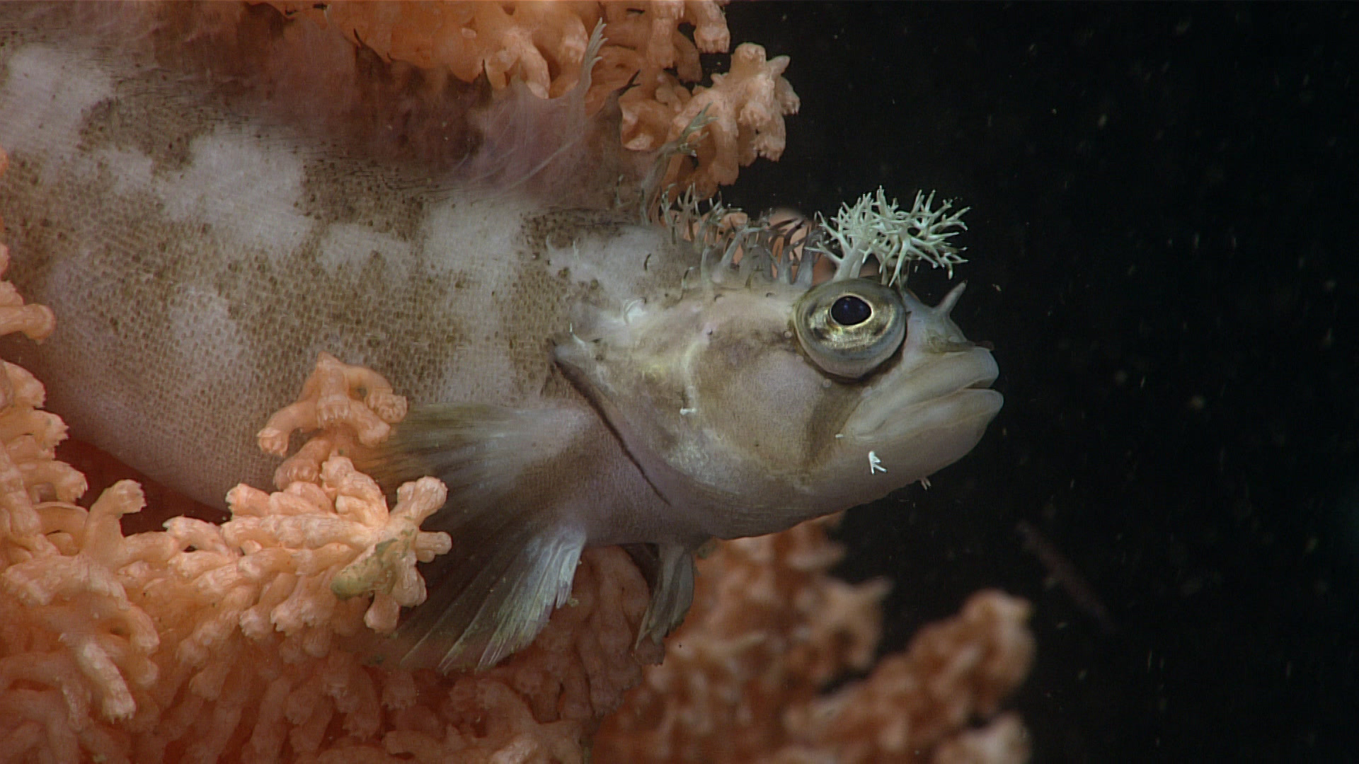
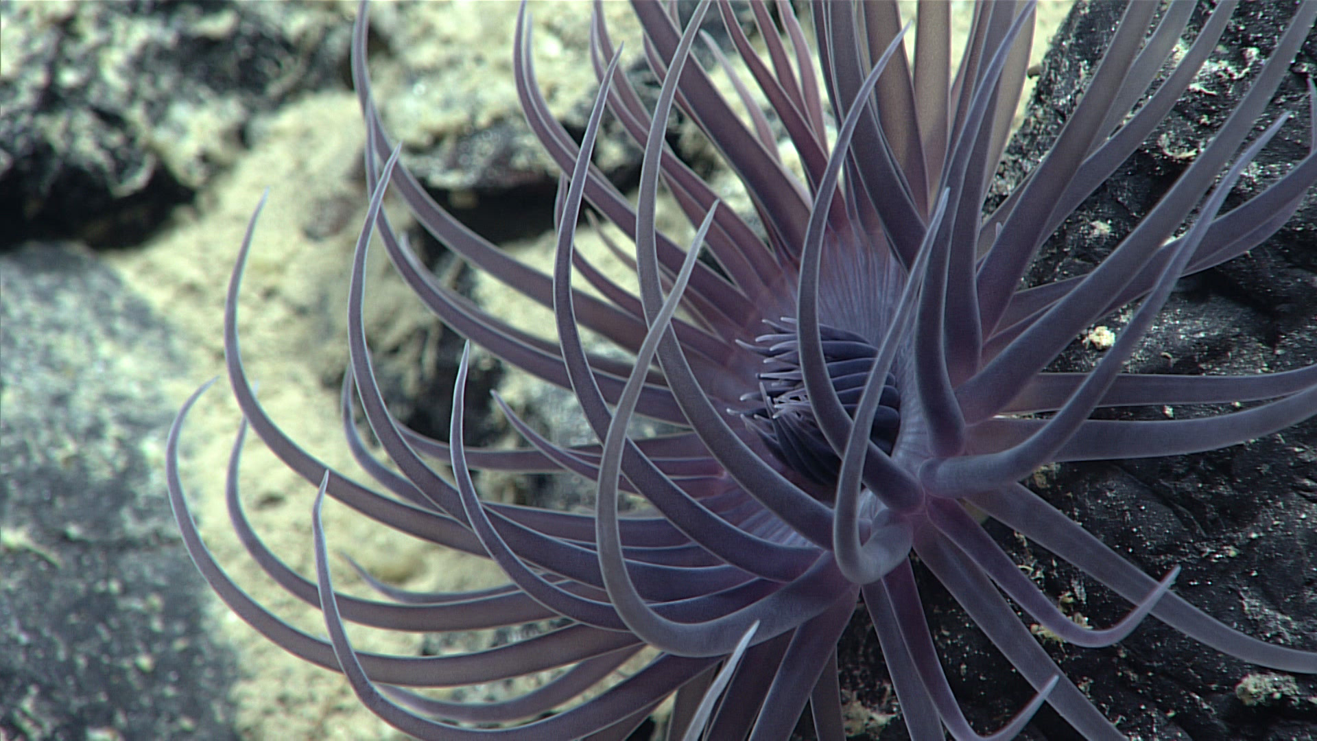
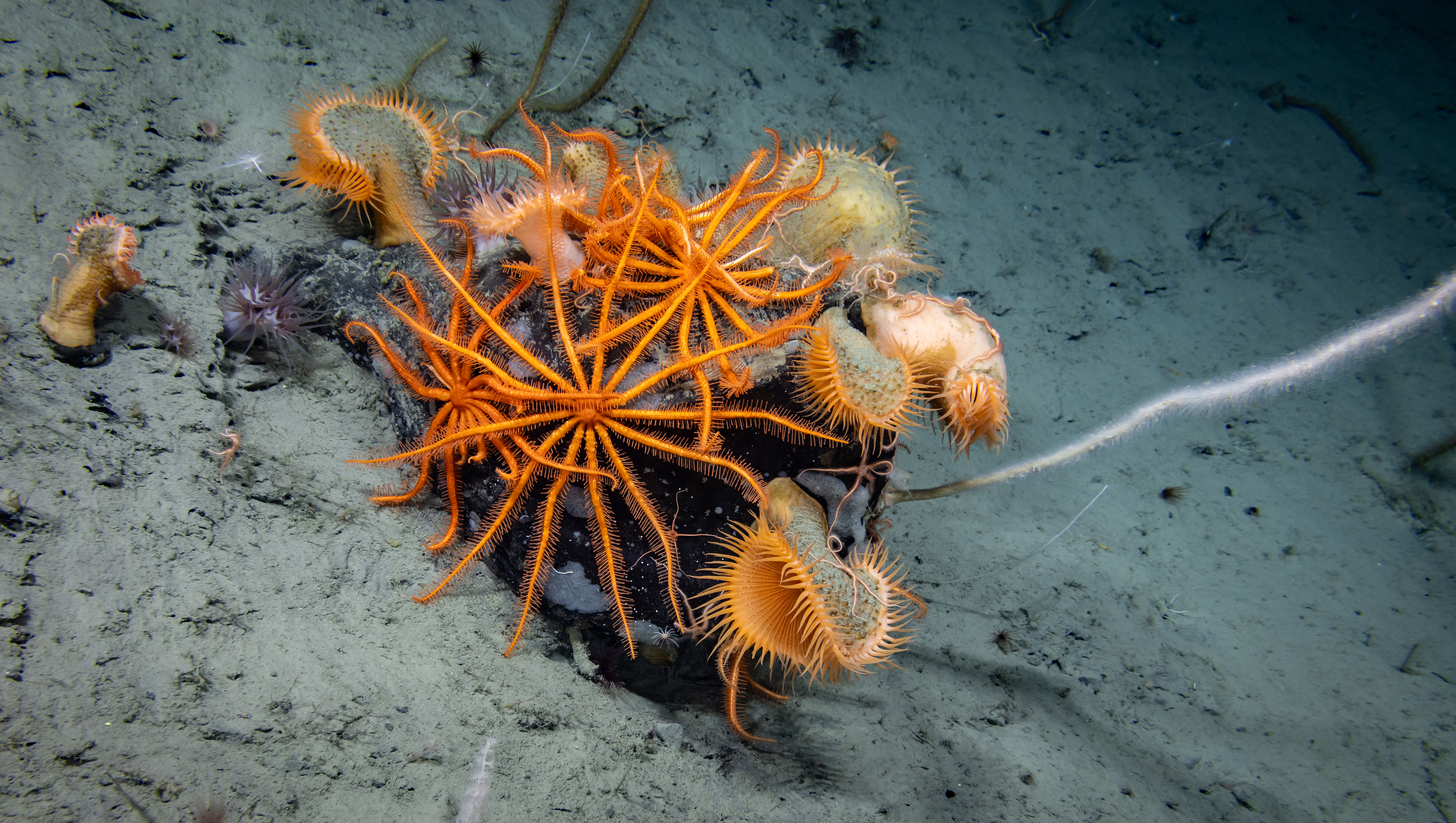
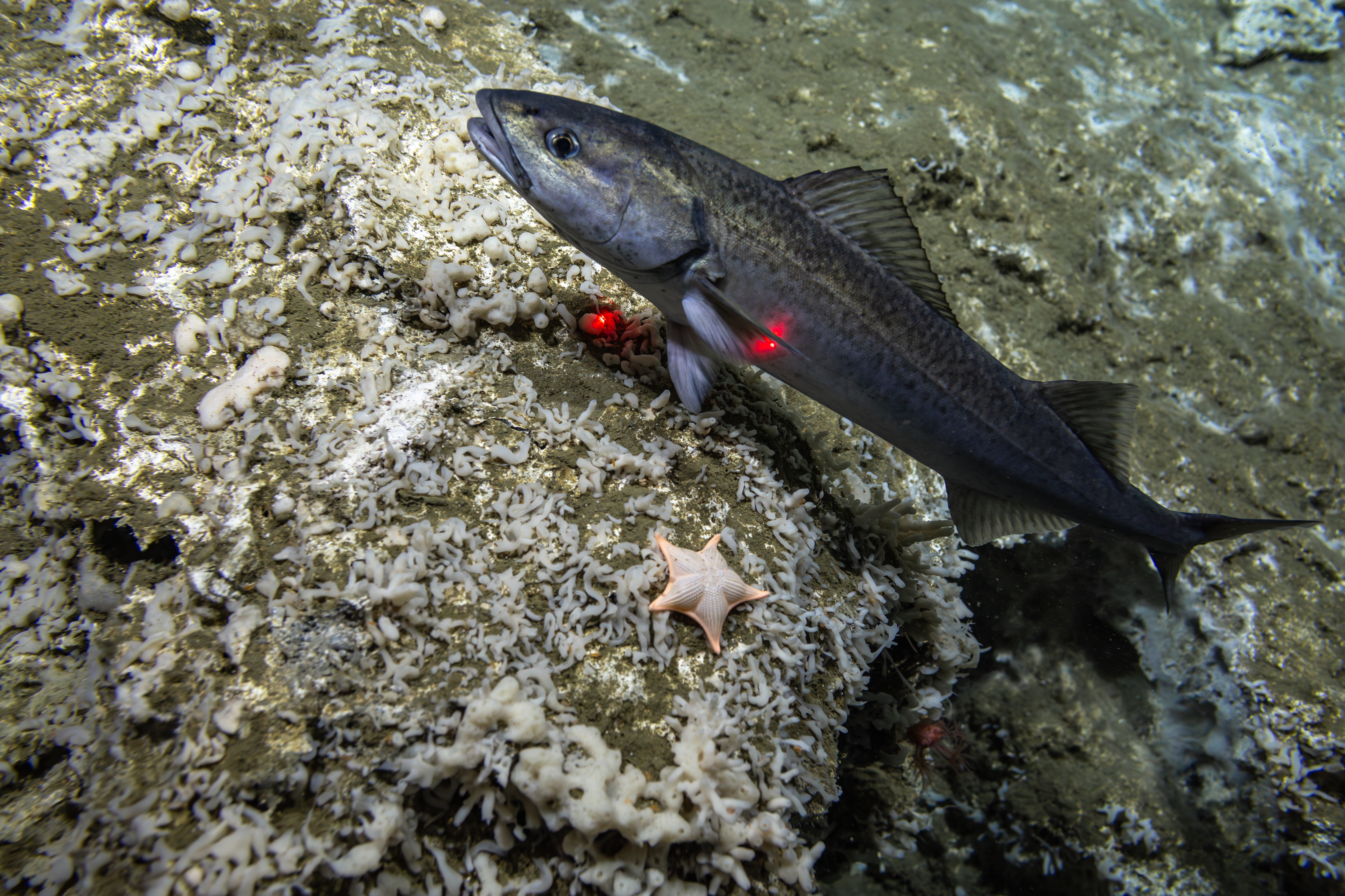

Dives
Seascape Alaska 5: Gulf of Alaska Remotely Operated Vehicle Exploration and Mapping included both mapping and remotely operated vehicle (ROV) operations, with video from ROV dives streamed online in real time while the expedition was underway.
The list below provides information about dives that took place during the expedition. Click on a dive name to find its location on the map and access a link to related image and video highlights. Links to final dive data and summaries will be added when available, after the expedition.
Education Content
Education theme pages provide the best of what the NOAA Ocean Exploration website has to offer to support educators in the classroom during this expedition. Each theme page includes expedition features, lessons, multimedia, career information, and associated past expeditions.


Exploration Team
Naming every participant in a telepresence-enabled expedition is next to impossible, as scientists from around the world have provided input into the expedition plan. However, we've assembled information about the members of the team who are sailing on the ship and participating in the expedition from sea – meet the team!


Related Links
Expeditions
- 2023 Seascape Alaska Expeditions (EX2302-EX2308)
- NOAA Ship Okeanos Explorer: 2023 Expeditions Overview
- Introducing Seascape Alaska
Technology
Media Contacts
Emily Crum
Communication Specialist
NOAA Ocean Exploration
ocean-explore-comms@noaa.gov
Keeley Belva
Public Affairs Officer
NOAA Office of Marine and Aviation Operations
keeley.belva@noaa.gov
For more information, visit the Media Resources page.
NOAA Ocean Exploration’s 2023 Seascape Alaska expeditions will contribute to the National Strategy for Exploring, Mapping, and Characterizing the United States Exclusive Economic Zone, Seabed 2030, and multipartner Seascape Alaska campaign, which has been endorsed by the Intergovernmental Oceanographic Commission of UNESCO as part of the United Nations Decade of Ocean Science for Sustainable Development 2021-2030.
Data collected during all expeditions will be available in NOAA’s public data archives within 90-120 days of its completion and will be accessible via the NOAA Ocean Exploration Data Atlas.
Published August 17, 2023
Last updated January 22, 2024