

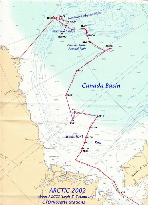
This map depicts the Louis’ track during the four-week expedition as well as the location of the 44 CTD casts performed along the way. Image courtesy of Arctic Exploration 2002, Bon Van Hardenberg, Institute for Ocean Sciences Canada, NOAA/OER.
Related Links
Arctic Exploration: Mission Summary - Measuring the Physical Properties of the Deep Canada Basin