

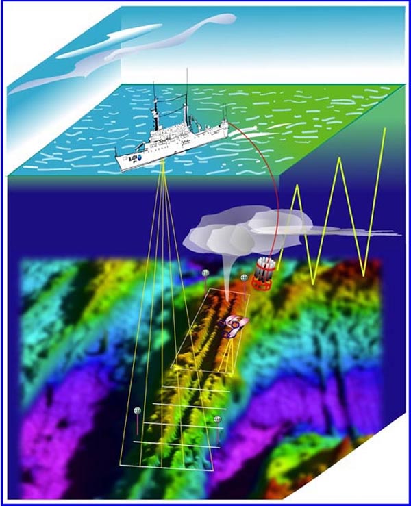
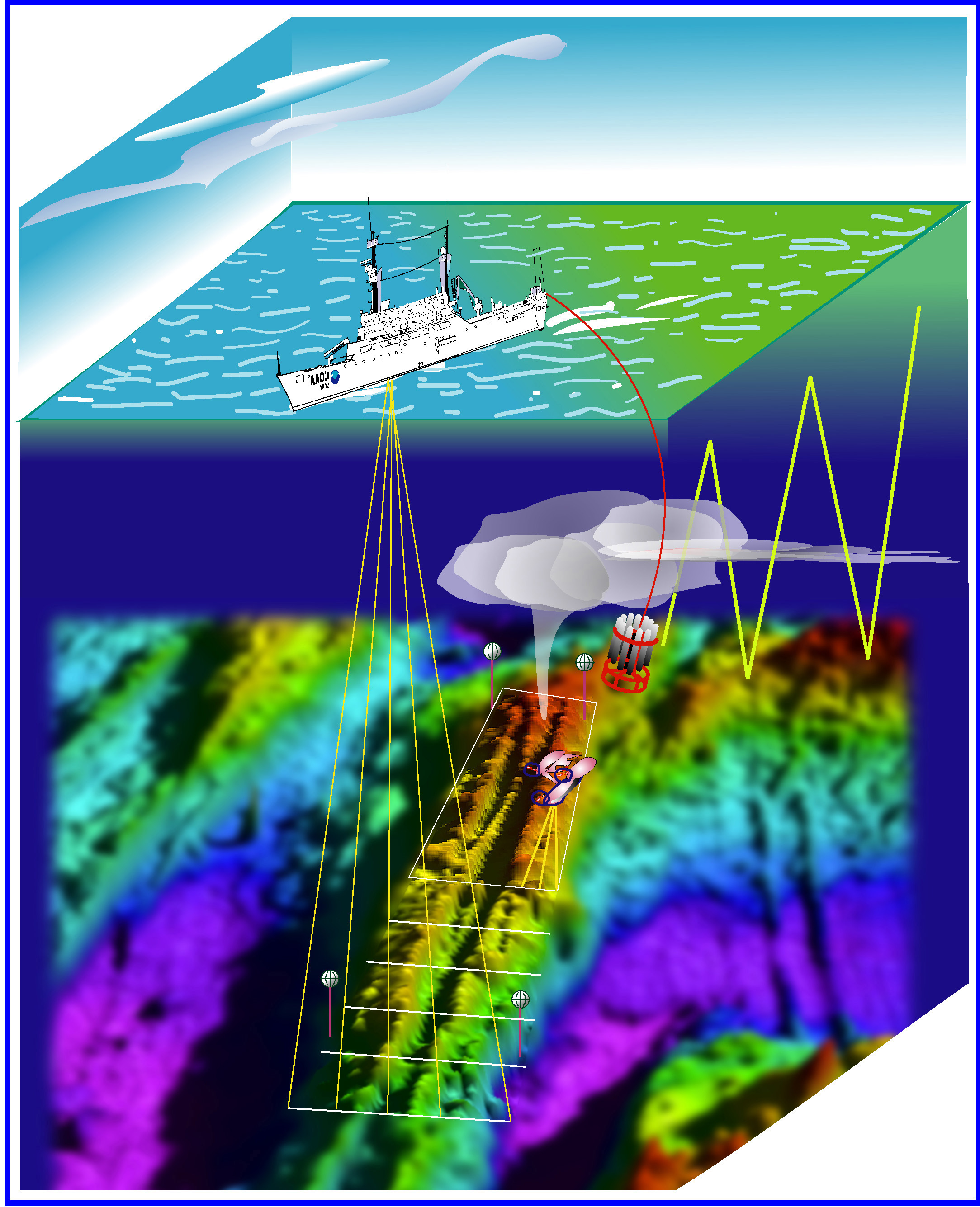
Representation (ship and instruments not to scale with seafloor features) of surveys during Leg I of Submarine Ring of Fire Explorer Ridge taking place June 28 to July 11. The topography of the Explorer Ridge area is shown to varying degrees of clarity according to the resolution of the survey. The areas were originally surveyed 20 years ago by a lower resolution sonar. This shows up as a blurry image over much of the area. At the stage of the survey shown here, only the axis of the ridge has been surveyed using the new high resolution sonar on R/V Thomas G. Thompson (TGT) and this part of the image shows more detail. The yellow lines emanating from TGT represents sonar swath. The most detail shows up in the rectangular area being surveyed by the Autonomous Vehicle ABE with its very high-resolution survey. ABE also carries a magnetometer (for measurement of variations in the ridge's magnetic properties). Object towed from TGT is a CTD/Rosette (See detailed discussion under Plumes section). This instrument is towed by cable in the zigzag (up and down) path known as a “tow-yo”. The tow-yo survey commonly detects the horizontally layered portion of the plume (“neutrally buoyant plume”) and less often the warmer core that rises directly (shown as the vertical stem) above the vent (“buoyant plume”). The large bottles on the CTD (shown as grayish tubes) collect samples of the plume water on command from the surface. The stick-like objects with the spheres on top are acoustic transponders used to navigate ABE and (in Phase 2) the remotely operated vehicle ROPOS. After these are deployed on the seafloor, they are carefully “surveyed in” by making multiple acoustic ranges and calibrating that to the GPS position of the vessel. Once their precise geographic position is known, instruments or vehicles can position themselves precisely by triangulating on the transponders using acoustic pulses. global view of the Pacific Ring of Fire, showing Mid-Ocean Ridge and Island Arc/Trench Systems. Explorer Ridge and the Marianas Volcanic Arc are shown, as well as the East Pacific Rise. Image courtesy of Submarine Ring of Fire 2002, NOAA/OER.