

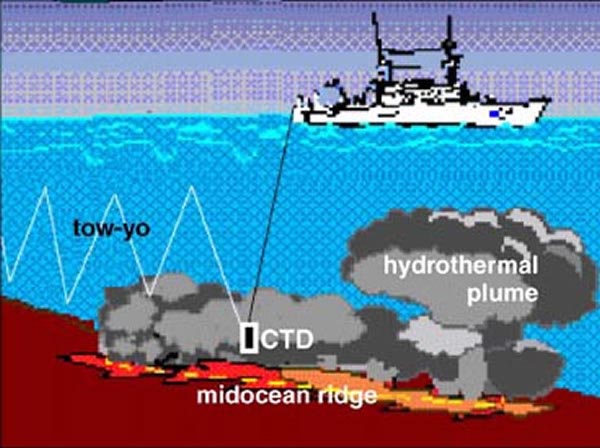
An illustration of a CTD “tow-yo” survey to map hydrothermal plumes. The research ship steams along the midocean ridge, trailing the CTD sensor package behind it. This package is continuously winched up and down, forming a sawtooth pattern through the water. The resulting data stream can be used to construct a two-dimensional image of the underwater plume. Image courtesy of Submarine Ring of Fire 2002, NOAA/OER.