

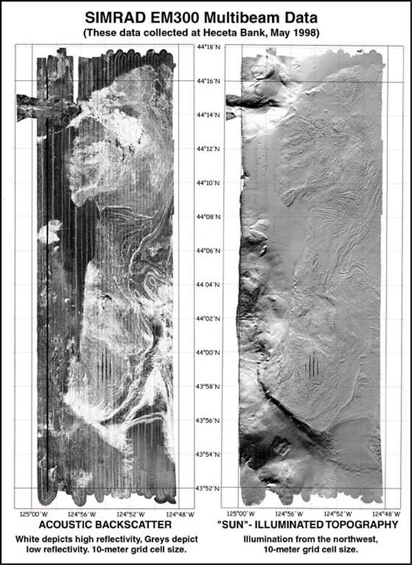
Heceta Bank Simrad EM 300 backscatter (left) and topography (right) on 10m grids. The backscatter image reveals seafloor physical properties and texture of the seabed. White areas depict high reflectivity (cobble, boulder and sand). Black areas depict low reflectivity (mud). The topography image is "illuminated" from the northwest. The shelf break is apparent on the southwest portion of the bank. Ridges, folds and jointed bedding planes are easily discerned on the shallow portions of the bank. Image courtesy of Submarine Ring of Fire 2002, NOAA/OER.
Related Links
Submarine Ring of Fire 2002: Seafloor Mapping