
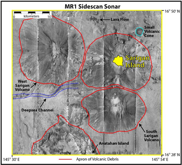
Mosaic of four sections of MR1 survey lines around Sarigan Island. The four evenly spaced north-south lines indicate the tracklines directly beneath the center of the ship, called nadir. The sidescan resolution is 16 meters.

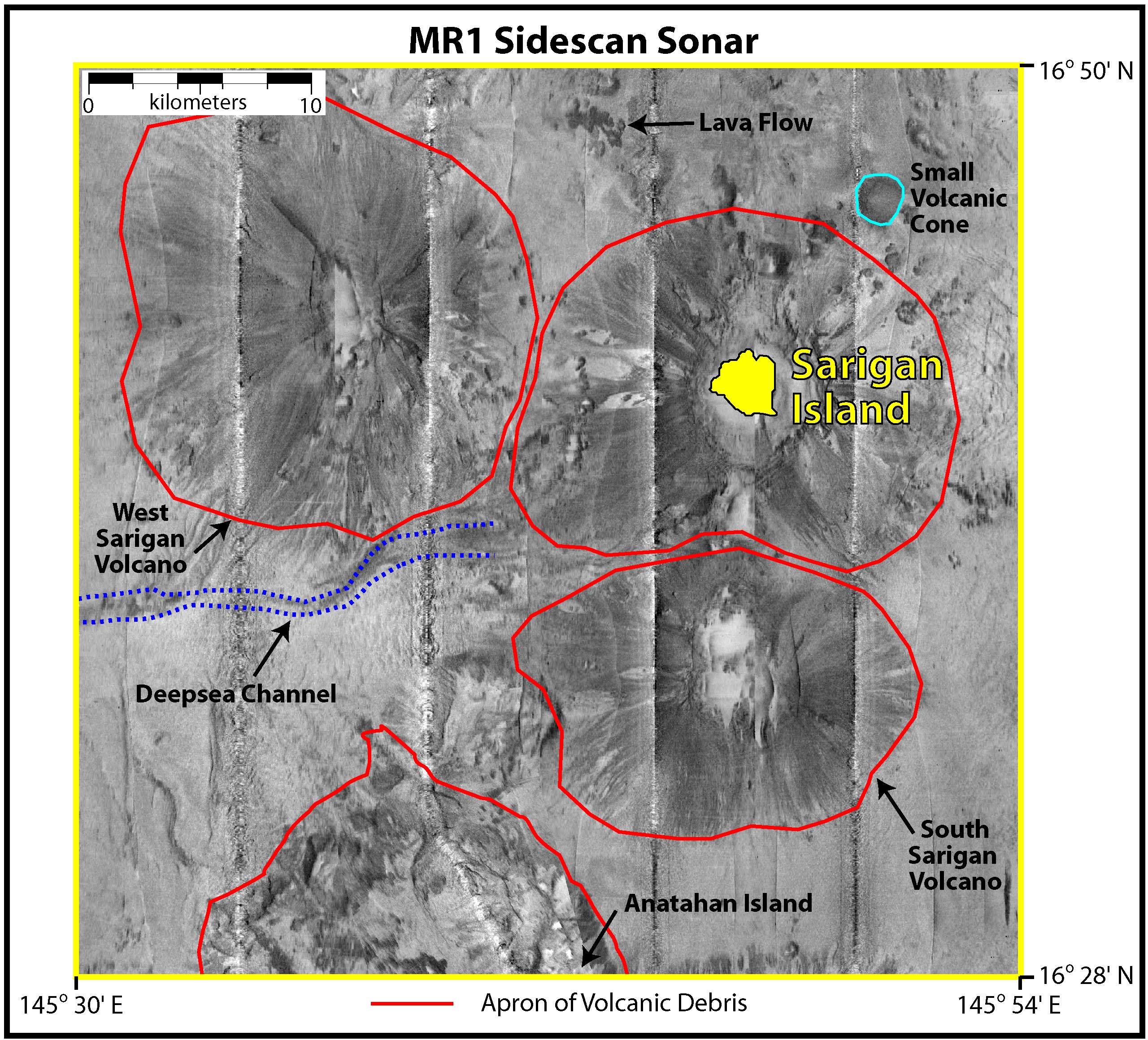
Mosaic of four sections of MR1 survey lines around Sarigan Island. The four evenly spaced north-south lines indicate the tracklines directly beneath the center of the ship, called nadir. The sidescan resolution is 16 meters.