

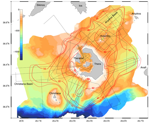
Figure 1: General map of area, showing location of Santorini (Thera) caldera and the Kolumbo submarine volcano and the distribution of the Minoan submarine pyroclastic flow deposit. The black dashed lines are seismic surveys. The red lines are contour lines of thickness of the Minoan submarine pyroclastic deposit, in meters. The dashed red line is the outer limit of the submarine deposit from this eruption. Figure courtesy of Haraldur Sigurdsson, Steven Carey, Matina Alexandir and Katy Croff.
Related Links