By M. Dennis Hanisak, Chief Scientist for the Coral Ecosystem Connectivity 2015 Cruise, and Research Professor - Florida Atlantic University - Harbor Branch
August 29, 2015

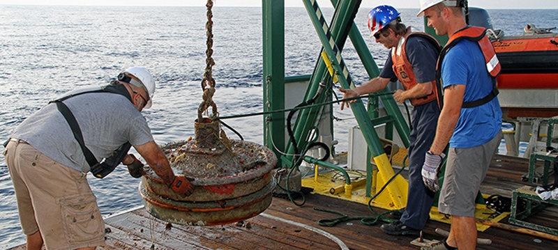
The excellent work of the crew of the R/V Walton Smith was instrumental in today’s successful recovery of the physical oceanography moorings. At this site, Electronics Technician Dennis Ilias, Chief Engineer Mike Shoup, and First Mate Steve Deschenes (left to right) are near the end of the recovery, safely placing on the deck railroad wheels that weigh 700 pounds each! Image courtesy of Brian Cousin, FAU-Harbor Branch. Download larger version (jpg, 788 KB).
Today rather than continuing our remotely operated vehicle surveys, we switched gears and addressed two other important tasks of the cruise: recovery of the three physical oceanography moorings (installed in 2012) and deployment of drifters at each of these sites. Both of these efforts directly relate to improving our ability to better characterize the physical environment of Pulley Ridge and the Tortugas area.
The data collected by instruments on the moorings and by the drifters are being analyzed by our Physical Oceanography team (Ryan Smith, NOAA’s Atlantic Oceanographic and Meteorological Laboratory; Villy Kourafalou, University of Miami’s Rosenstiel School of Marine and Atmospheric Science; and Arnoldo Valle-Levinson, University of Florida). This team is developing models on the oceanographic connectivity between Pulley Ridge and the Florida Keys. A hydrodynamic model of Pulley Ridge, the Florida Keys, the southwest Florida shelf, and the Straits of Florida will interface with a biological model to look at the potential biological/population connectivity of marine organisms across the region.
Instrumentation at the three physical oceanographic mooring sites (one at Pulley Ridge and two in the Tortugas) provided hourly measurements of ocean temperature, salinity, and current velocity for almost three years. The data recorded at each site are being used to validate the model’s performance. In June, the instruments were successfully retrieved by technical divers on the M/V Spree.

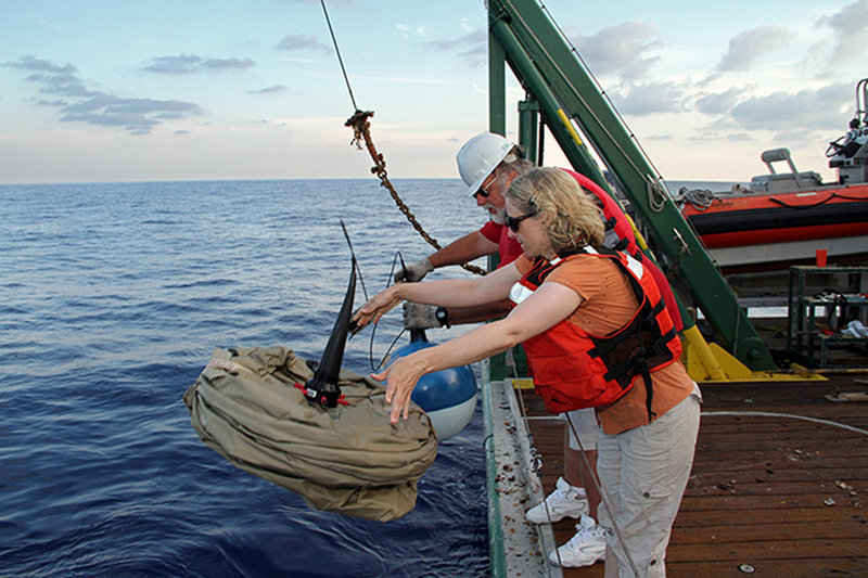
At each of the three Physical Oceanography sites, our NOAA Project Manager Kimberly Puglise and Chief Scientist Dennis Hanisak deployed a satellite-tracked surface drifting buoy (“drifter”) from the R/V Walton Smith to track the regional circulation patterns occurring during these surveys. Each drifter will transmit data for about three months. Image courtesy of Brian Cousin, FAU-Harbor Branch. Download larger version (jpg, 536 KB).
Recovery of the moorings required considerable teamwork between the ship’s crew and the scientific party throughout the day. We had to locate the sub-surface buoy markers (positioned 30 feet below the surface), hook up to them, then carefully retrieve the mooring lines, and stow them on deck. Our successful retrieval of all three moorings also allows us to examine the wear and tear experienced by three years of immersion and fouling at sea.
At each of the three sites, following recovery of the moorings, we deployed satellite-tracked surface drifting buoys (“drifters”) from the Research Vessel Walton Smith to help us track the regional circulation patterns occurring over the next few months. Measurements collected from our previous drifter deployments show that the direction and magnitude of daily mean currents observed at Pulley Ridge are greatly influenced by the configuration of the Loop Current. Computer model results for current flow at Pulley Ridge generated from these data are being compared with our moored data set. The actual measurements and model output are in good agreement, which further substantiates that the physical oceanography model is successfully simulating the regional ocean circulation.

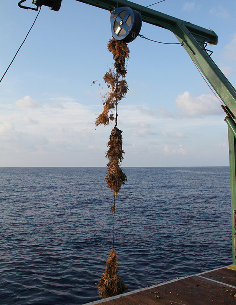
Mooring lines, like anything that we put in the ocean, gets fouled by a multitude of organisms, which increases the drag on the lines. The fouling on each of the mooring lines we recovered today after three years of immersion varied, being lowest at Pulley Ridge and highest in the north Tortugas (shown). Image courtesy of Brian Cousin, FAU-Harbor Branch. Download larger version (jpg, 725 KB).
This project is the first major opportunity to explore the physical and biological connectivity between the reefs of Pulley Ridge and the Florida Keys. The anticipated outcome of the project will be the development of tools that resource managers can use to develop effective strategies for protecting these valuable ecosystems. More information on the physical oceanography component of this project is available here.