By Eric Stackpole and David Lang, OpenROV

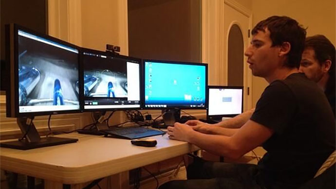
Explorers will guide the ROVs from an on-shore command center, similar to this set up used during the 2014 expedition. Image courtesy of OpenROV. Download image (64 KB).
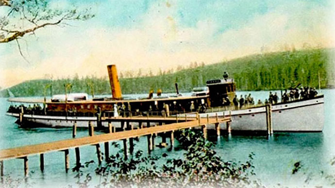
In 1940, the 50-meter-long "Steamer Tahoe" was scuttled in Glenbrook Bay on the east side of Lake Tahoe in Nevada. The owners of the steamship intended for it to sink in shallow enough water for tourists to see it from a glass-bottom boat, but the ship was sunk too far from shore and ended up landing on a slope and sliding do a depth between 110 and 150 meters. Because of its great depth in a high-altitude lake, very few divers have ever been able to see the sunken ship or examine the interior spaces.
In April 2014 , our team headed to Lake Tahoe to document the SS Tahoe using OpenROV submarines and to record video of its hull. The expedition was modestly successful, especially in terms of testing equipment, but left us wanting more.
Now, on June 7-8, 2016, we are going back . This time, we are also bringing our new OpenROV Trident, an underwater drone, as well as a number of custom remotely operated vehicles (ROVs), to attempt to better document the wreck.
Primary exploration days will be June 7 and 8. On these days, all things permitting, we plan to conduct two or three several-hour dives each day. A “command center” will be set up on shore to observe and guide dives, while small teams will take boats to the wreck dive site.

Small boat set up that the team will use to deploy ROVs during the expedition. Image courtesy of OpenROV. Download image (109 KB).
As part of the expedition, we've outfitted a small inflatable boat with long-range communication equipment, an ultra-short baseline (USBL) acoustic positioning system, and a low-cost dynamic positioning system. Our purpose for building this system was to demonstrate that many of the capabilities one might think would require a large research vessel can actually be achieved with off-the-shelf parts that are more portable and much less expensive.
One challenge associated with investigating a deep object throughout numerous deployments is finding the same location across each dive. During the deployment to the SS Tahoe two years ago, it took multiple dives and several hours of searching before we finally located the wreck visually with the ROV, and finding it again during subsequent dives proved to be just as difficult.
For the expedition this year, we’re considering several ways to place a marker near (but not touching) the wreck, so an ROV will be able to easily follow that line to the location of the wreck at the beginning of each deployment.
The activities of the team will be documented on OpenExplorer.com , a website designed to share exploration activities around the world. The website serves as a digital field journal where anyone can share the different stages of expeditions, from planning to execution and wrap-up.
The online forum is designed to build a community of like-minded citizen explorers who can share ideas, support each other, and learn more about the world around them. Members don’t need to be working scientists or engineers with grants and funding behind them – they just need a passion and enthusiasm for sharing, following, and contributing to adventures.
In the age of growing citizen explorers, OpenExplorer represents as new way to explore, together.