Seascape Alaska 4: Gulf of Alaska Deepwater Mapping
(EX2305)
Reflections of an Explorer-In-Training
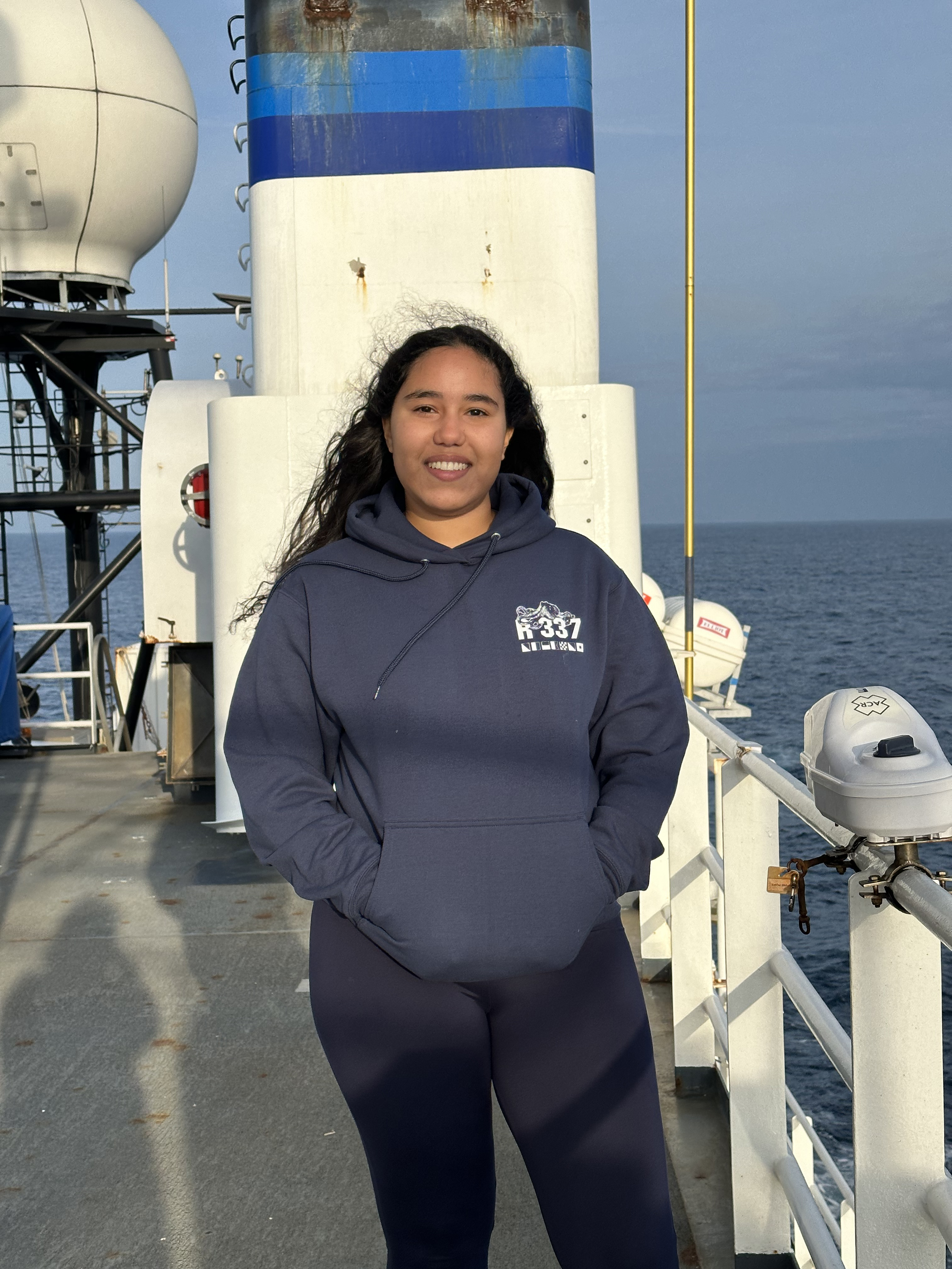
I, Brianna Gomérez, participated in the Seascape Alaska 4: Gulf of Alaska Deepwater Mapping expedition as an Explorer-in-Training (EiT) aboard NOAA Ship Okeanos Explorer to assist NOAA Ocean Exploration in mapping seamounts in the Gulf of Alaska. In this journal, written during my 18 days at sea, I document all that I learned, not only about remote sensing, but also about myself and the kind of marine scientist I aspire to be.
What I Learned
On day one at sea, the Seascape Alaska 4 expedition coordinator, Thomas Morrow, assigned me Standard Operating Procedure manuals (SOPs) to read as background to familiarize myself with the technology we would be using. Here’s what I learned from this assignment.
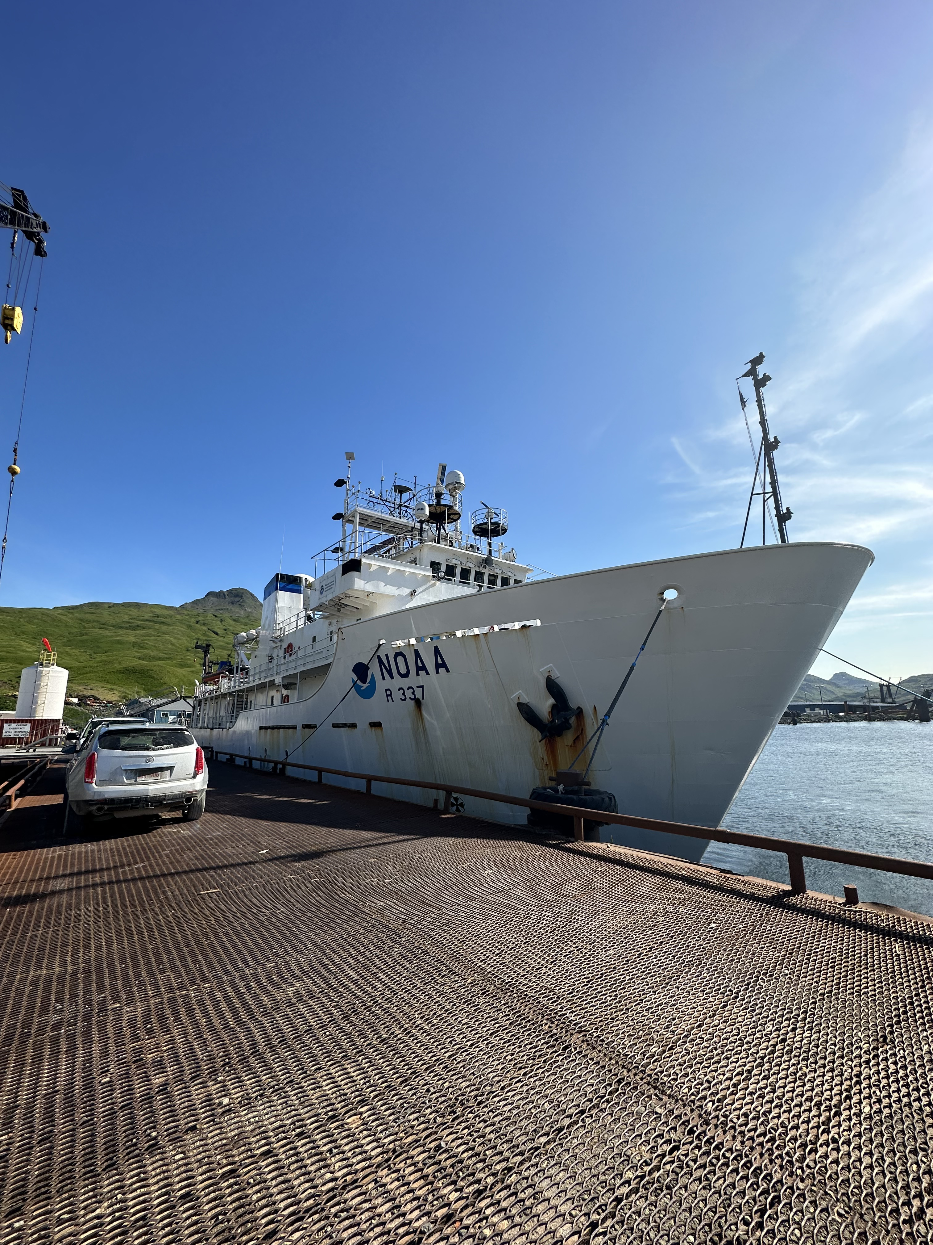
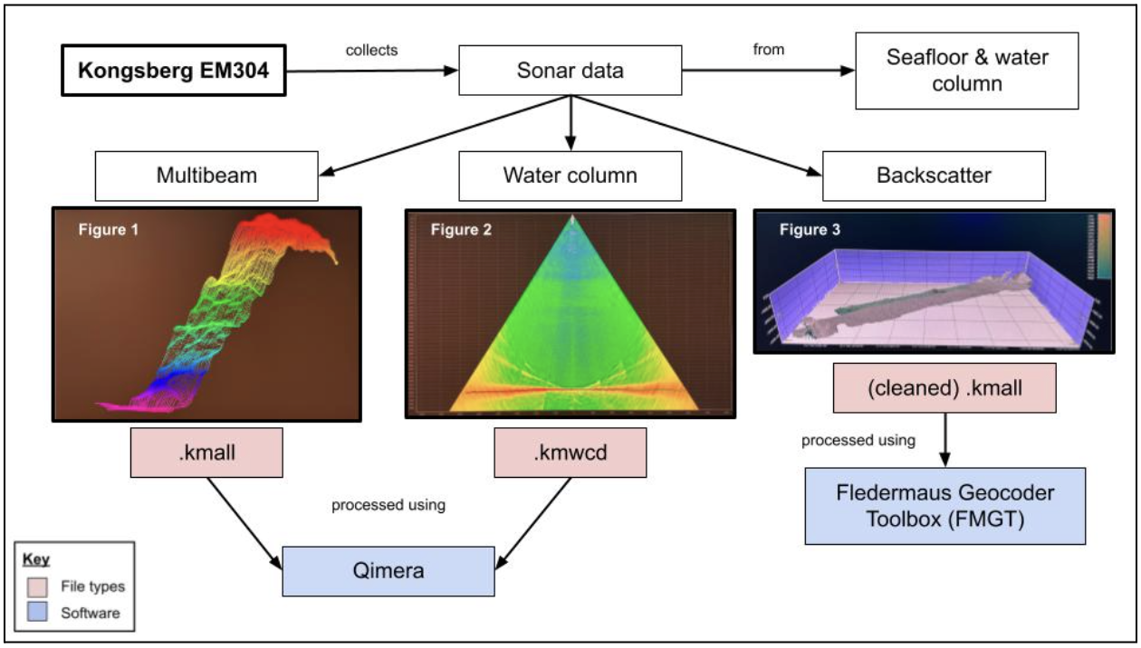
First, some vocabulary. MBES stands for multibeam echosounders. Tx means transmit array because it sends the initial pulse downward in remote sensing, as opposed to receiver arrays, or Rx, which listen for the returning pulse. Okeanos Explorer is equipped with a Kongsberg EM 304 multibeam sonar; usually simply referred to as the "multibeam" by the crew. This sonar has some pretty impressive abilities, including the ability to send out 1,600 beams at once at frequencies between 20 and 32 kHz (kilohertz). These beams can stretch down to a depth of over 6,000 meters (3.7 miles) with a swath of about 140°.
While sitting in the survey room one shift with mapping watch lead Marcel Peliks and fellow EiT Mary Ella (Mella) Rinzler, we contemplated the multibeam's swath size and blew our own minds when we realized this meant the multibeam was mapping seafloor that was past the horizon on both the port and starboard sides of the ship. Woah.
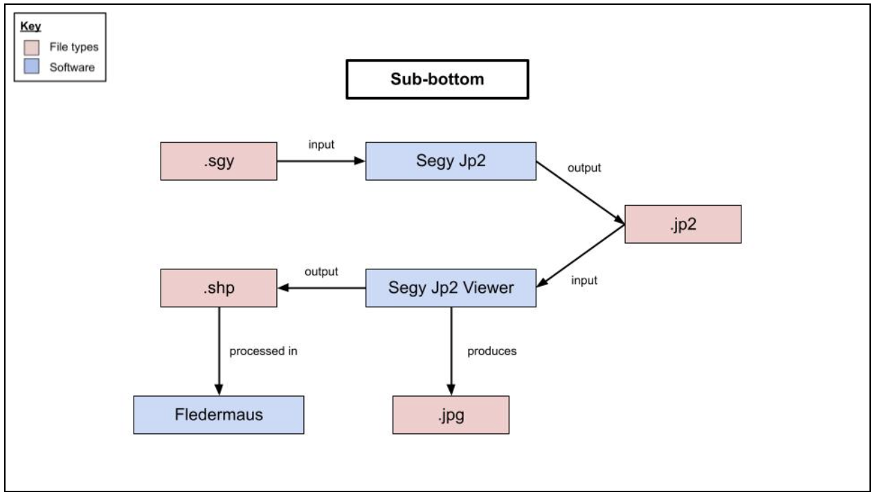
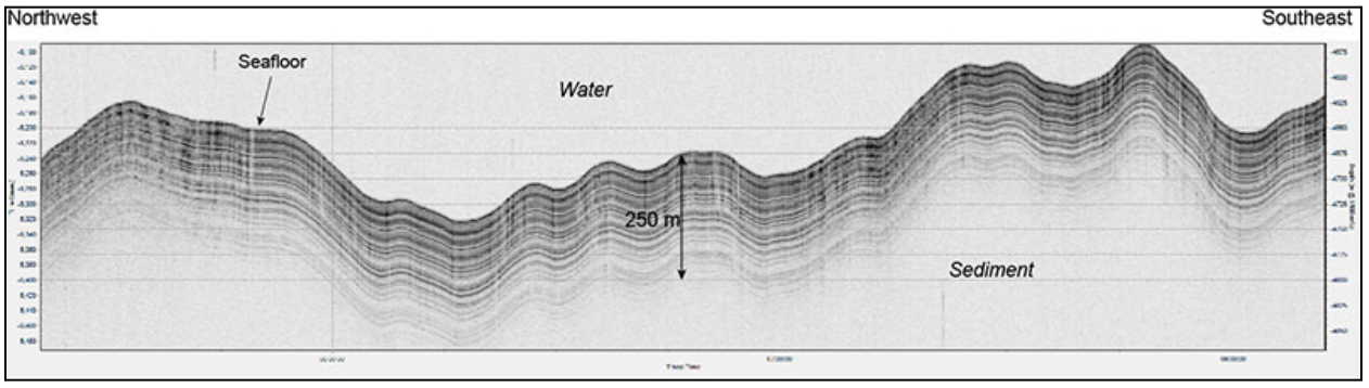
The second important piece of equipment used for mapping operations on the ship is the sub-bottom profiler. I still can’t believe scientists can collect not just seafloor data, but seismic profiles of the layers below the seafloor as well! The profiler on Okeanos Explorer is a Knudsen 3260, which the crew usually called “the Knudsen.” The Knudsen operated at a frequency of 3.5 kHz and could reach a depth of 10,000 meters (6.2 miles). One of my favorite products to create during this experience were sub-bottom profiles because I was always amazed by the quality of the layers in the images – the distinct black and gray sediment layers. I wondered about the layers’ ages and what ancient fossils could be buried between them.
There were a few other important technologies I learned about, like the split-beam sonar, which detects acoustic signals from objects both biotic (alive) and abiotic (not alive) in the water column. Okeanos Explorer has EK60 echosounders operating at either 18, 38, 70, 120, or 200 kHz depending on the situation.
The acoustic doppler current profiler, or ADCP, measures the speed and direction of ocean currents using the principle of doppler shift (particles moving toward the instrument return waves of a higher pitch, while ones moving away return waves of the opposite). I did not work with these much, but Okeanos Explorer has a Workhorse Mariner ADCP and an Ocean Surveyor ADCP.
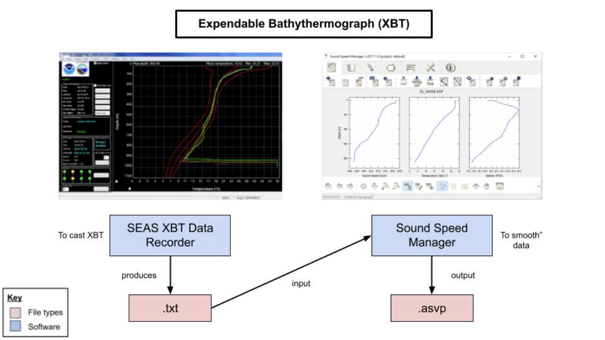
I did, however, often use ancillary instrumentation for position, motion, and speed corrections, particularly XBTs, which stand for expendable bathythermographs. Launching these bad boys and competing in the Xtreme XBT games was a fun highlight of living aboard the ship. These torpedo-shaped rockets survey an area to capture any changes in the water column that would affect the sound velocity. They launch from the back of the ship with a “thoomp” sound and could be tracked from the survey room using SEAS XBT Data Recorder.
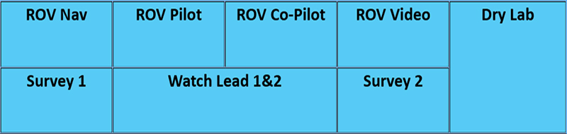
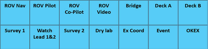
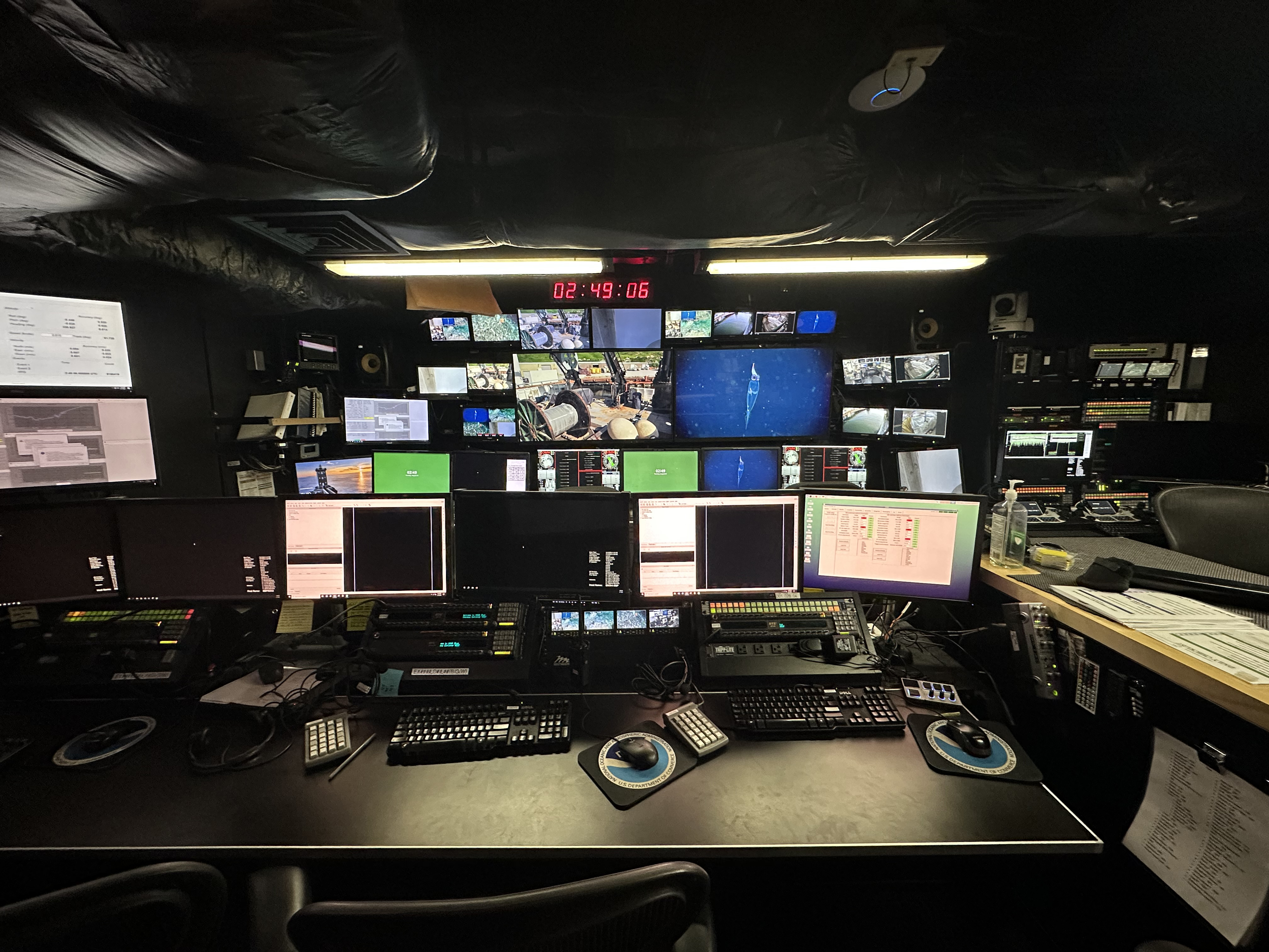
The last things I needed to learn on my first day were the KVM (keyboard, video, mouse) and intercom systems. All monitors are linked to and capable of accessing a number of different computers in the server room and cameras on the ship. One very cool design is that the positions of the possible audiences on the radio mimic their physical positions on the ship. I charted the layouts below to easily remember my way around the workspaces I would be using for the next three weeks.
What I Did
August 1, 2023- XBT loading
- Intro reading
- KVM, intercom, router training
First day! It’s been exciting meeting everyone and familiarizing myself with all the tech. I talked to a few people on the crew, like Marcel and Olivia, and learned everyone comes from pretty different backgrounds. I work in Mission Control, which looks like a wicked spaceship straight out of a movie! I loaded the XBT launcher – I don't totally understand it but it looks like a torpedo. Roland taught me the basics about the KVM system and how to use the radio. I felt pretty cool talking to the bridge, not gonna lie.
Not much to do today as we’re still in transit to the mapping area. Thomas showed the team and I the polygons we plan to cover. I swiped a book from the dry lab about how NOAA explores, so I’ll fill the down time reading that since I’m new to mapping.
- Cleaning
- XBT casting
- Familiarization with Qimera, SEAS XBT Data Recorder, Sound Speed Manager, Okeanos Explorer’s logging system
We started mapping and I had things to do in the control room. The mapped data looks so cool, I can’t believe we get outlines of the seafloor so fast. Don’t know how long I expected it takes scientists to get data this high-def, but I didn’t think it’d be this quick.
We clean the outlier pings taken by the multibeam in a software called Qimera. Learned how to launch the XBTs I loaded yesterday. We use a software called SEAS XBT Data Recorder to track its depth before releasing the little missile, and record the highest scores on the black board. The team calls the game Xtreme XBT and it’s super fun. After that we export the data to Sound Speed Manager where we smooth it a bit before using it for upcoming lines. I asked Marcel if it’s a calibration and he clarified for me that the XBTs are more of a correction that take into account changing water conditions.
- Cleaning
- XBT casting
- Familiarization with SeaPath navigation system, hydrophones
- Whale watching
- Bird watching
- Ocean debris counting
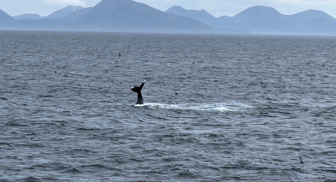
I. Saw. WHALES! I used the binoculars from the dry lab and I could see their little puffs and dorsal fins in the distance. It was awesome! Also, Roland taught me about the hydrophones…next time the bridge calls in about whales, I’ll tune in and maybe I’ll hear them. Also used the binoculars to do some bird watching. Lots of little seagulls out in the water. Crazy, I didn’t know they sit in the water this far out. Don’t their little legs get cold? Also discovered the stairs to the bridge and the Commanding Officer for Okeanos Explorer, Captain Colin Little, let me hang out there for a while. Got the best views of the whales then. Sadly, I started a count of ocean debris because I saw two ghost nets as we sailed on.
- Cleaning
- Water column
- XBT casting
- Whale watching
- Ocean debris counting
I went outside a lot today. Saw gorgeous whales, a funny-looking bird, and two more lonely nets. I learned how to navigate the file system we use on the ship, and it’s a lot less confusing than it was the first day. Abby requested we give feedback. While I enjoy figuring things out along the way, I might suggest that incoming interns get a crash course on the local and shared drives.
I started a new goal: water column exploration! We review the swaths of data looking for anomalies, like bubbles caused by seeps! Marcel told me the person who finds one gets to name it…I know my quest.
- Familiarization of exporting files in .csv through Qimera for logging
- Sun Photometer reading with Marce
- Cleaning
- Water column
Crazy thing, Joe, Mella, and I all got the same XBT score…TO THE THIRD DECIMAL POINT. So we’re all tied for first in Xtreme XBT in the most unbelievable way.
I started taking breaks every hour or so to get up, stretch, and do some squats because I’m starting to feel a bit cramped. Going outside for fresh air is the calmest. I love watching the water. The best part of today: I saw a whale’s fluke! I wish they got closer to the ship so I could see more of them but we’re probably the loudest, weird-looking fish they’ve ever seen. Only one ghost net today.
- Observed EK calibration setup with Abby and Thomas
- Backscatter project creation with Joe
- Observed EK calibration reel test with Abby and Thomas
- Observed EK calibration sphere positioning with James and crew
- Cleaning
- Water column
- Public journal creation
- XBT casting
Today was EK calibration day. Us EiTs don’t work on the EKs themselves very much, so it was cool to get involved with them a bit. I observed Thomas and Abby checking the poles’ reel system. Then, I watched the crew get the ball in position under the boat. I got to hold a walkie for a second and felt like I was helping. I learned how to update the logs with the file names using an export feature of Qimera to get an Excel list of the files and the file info. Cleaned the most lines today, nine, and I’ve definitely gotten the hang of it cause I’m much faster. Huge moon jelly and one ghost net in the water.
- Water column
- Visual understanding of Okeanos Explorer’s technology and survey products
- XBT casting
Weather was so intense today that I got really seasick. It was the worst. Even with dramamine, too. I guess they can only do so much and this is my first time on the high seas like this after all.
I started doodling the tools and technology we use in the control room to understand our projects and products. There’s so much, and we’re working with it all at once, so I need to understand the pipeline. I made a neat table to be able to understand the Kongsberg and the Knudsen sonars.
Thomas talked to me about posting the journal I’ve been keeping. It’d be great for public education of what our mapping team goes through and experience as an EiT. I’d really only intended it to keep track of the things I’ve learned and reflect on this amazing experience in the future, but if this ends up on the NOAA Ocean Exploration website…HELLO WORLD!
- Lots of file organization
- XBT casting
I got sick again today, how lame! It’s really got me doubting whether I might be suited for this line of work. I was just getting my sea legs, too! Everyone was very considerate, though, and I appreciated their understanding when I needed the break to let the nausea pass.
- Sub-bottom profiling
- Public journal creation
- Whale watching
Admittedly, I did very little aside from continuing to create my public journal and whale watching. It was a nice and calm day. Finally learned the sub-bottom profiler stuff, though. It was surprisingly quick and simple. Amazing how we can not only “see” to the seafloor, but beneath it, too! I’m proud of myself because I learned it on my own thanks to NOAA Ocean Exploration’s SOPs (standard operating procedures).
- Cleaning mapping data
- Whale watching
Mella and I went to the bridge deck to take headshot photos for the website and we saw so many whales. I noticed them out of the corner of my eyes both times. Turns out we saw them before the bridge did, so we knocked and let them know and they delivered the message to the control room where Marcel was. Sounds like there’s a “storm a comin’” that may put the mapping on hold.
- Backscatter
- Public journal creation
- Hung out with bridge
Worked on backscatter today, again on my own. And with that, I’ve achieved all the goals lined up for an EiT during this internship. Did nothing else but hang out with Marcel in the control room. One thing I’ve really enjoyed is that we can play music in there. So we sing and jam while doing our work.
The storm news has grown more worrisome. The plan, I think, is to leave the polygon and take cover behind some islands out west.
- Cleaning
- Public journal editing
- Whale watching
- Stargazing
WHALES! Whales – everywhere! The most amazing thing I’ve ever seen! They must’ve been feeding on a school because they were close to the surface and there were birds everywhere. Including puffins! They were so cute with their beautiful, rainbow beaks. Through the binoculars, I could confirm that the whales were humpbacks. Olivia said there were also fin whales. One was slapping the water with its fluke so many times. I got pictures and videos of some of them, but then put the phone down to enjoy the moment. One big one swam nearly under the bow and when it surfaced, I saw right into its blowhole.
Mella woke me up after 1 a.m. to stargaze and watch a meteor shower. I saw the most stars I’d ever seen in my life. You definitely can’t see the Milky Way back in New York City. The shooting stars were wicked beautiful.
- Fun night with the team
- Public journal editing
Today was Sundae Sunday and Spa Day. Good day for morale. I put on my clay mask and watched the movie, “How to Lose a Guy in 10 Days,” with others on the team.
Warren also gave me and the other EiTs a tour of the engine room. He lost me many times and I’m sure I couldn’t explain any of how the ship works to someone else, but it was still enjoyable. He even let us peek under the cover of the remotely operated vehicle.
- Resume revising
Worked on my resume today and started adding the software and skills I’ve been learning here. It’s much easier since I’ve been writing everything down. This version is gonna look stellar now that I’ve worked with NOAA. Mella and I hit the mess hall for some late night snacks and Encanto was playing in the library. I couldn’t resist.
- Resume revising
- Public journal editing
Things are so chill these days. I spent most of today outside on the picnic table and the bridge deck. Is it weird if everytime I look over the rails into the water, I mentally review my survival strategy for if I go overboard?
- Public journal editing
- Orca watching...I think
Chicken parm night! Gotta say, I’d been waiting for Arlene and the stewards to make chicken parm again cause it was so good that first week. Not that I was expecting gruel, but I’m glad the food here has been mostly healthy and diverse.
Abby texted the group chat that there was an orca on the port side. I was in bed and sat up so fast I hit my head on the top bunk. When I got to the deck, everyone in the bridge pointed to the whale and I saw its dorsal fin for a split second. It never resurfaced after that. Near miss.
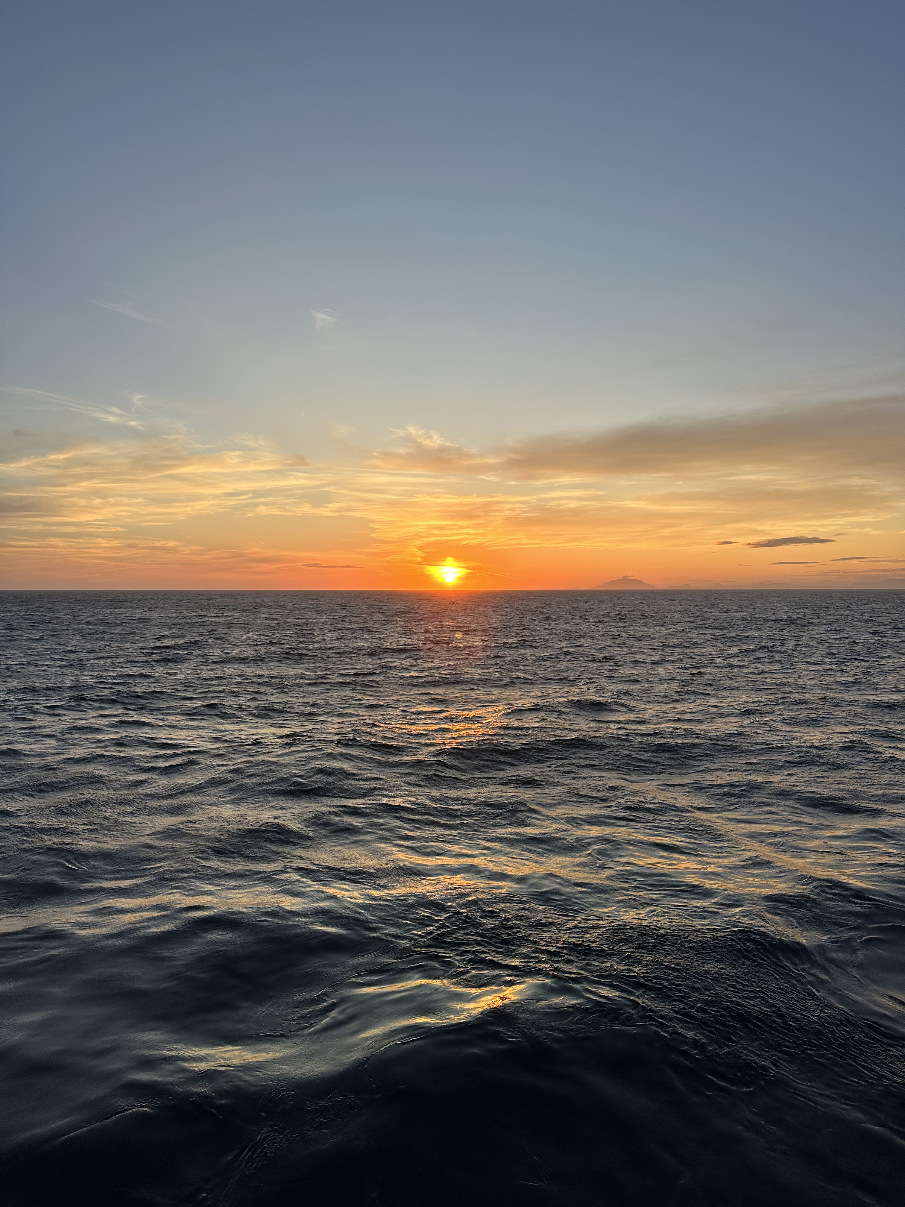
I watched the sunset with Marcel, Abby, Mella, and Joe. The sky’s colors were gorgeous. Joe and some folks in the bridge claimed they saw the green flash. Marcel, Mella, and I got some snacks and returned to the forward lounge to watch a movie, “Death on the Nile.” I’d seen it but Marcel hadn’t and predicted the ending within the first 10 minutes! What the heck? Am I just bad at watching movies?
- Sea glass hunting
- Dinner with the team
Last full day! Bittersweet really. This was a wicked cool time, but I miss the fam back home. I packed in the morning while the ship docked. When we were all tied up, I went outside and – wow. Kodiak is seriously gorgeous this time of year. The mountains look so green and lush, and I saw so many animals. More jellyfish right under the boat, fish jumping out the water every few seconds, seagulls and eagles, and the best: I finally saw an otter! Just one and not for a long time, but I’m glad I finally saw one before I left Alaska.
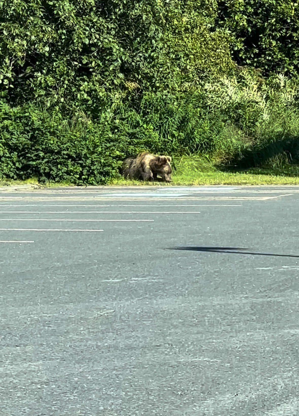
Olivia, Jen, Mella, Joe, and I went to a nearby beach to hunt for some seaglass. Got so many little nuggets to take with me. Jen found a seastar in the water! Finally, I went to eat sushi with the mapping team and Warren. Had a blast of a time. On the way, Thomas and I saw a big grizzly bear! Man, I’m really gonna miss seeing so much wildlife everyday. I feel ecstatic whenever I see something new.
By Brianna Gomérez, Explorer-in-Training
Published Feburary 6, 2024