
Explore past expeditions focused on documenting and increasing our understanding of underwater robots.
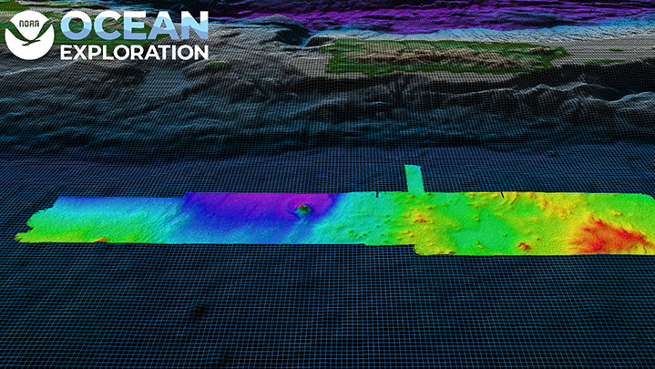
April 4-28, NOAA Ocean Exploration conducted an expedition on NOAA Ship Okeanos Explorer to fill deepwater mapping gaps in the Atlantic’s U.S. Exclusive Economic Zone (EEZ) and test deep-sea camera operations. Some of the remaining mapping gaps in waters deeper than 200 meters (656 feet) are around Puerto Rico. During this expedition, we mapped 26,628 square kilometers (10,281 square miles) of seafloor in Puerto Rico waters alone, making great progress toward filling these gaps. In total, we mapped 3,838 linear kilometers (2,385 miles) and 44,159 square kilometers (17,050 square miles) of seafloor — an area almost five times the size of Puerto Rico — using the ship’s deepwater mapping systems. Discoveries of note included seamounts and other interesting geological features south of Puerto Rico that will be further analyzed by the scientific community.
Read more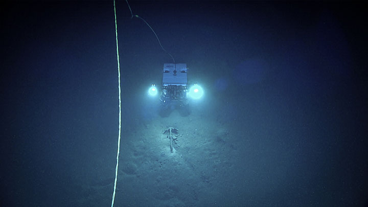
February 23-March 3, 2022, NOAA Ocean Exploration led an expedition in the Gulf of Mexico and the western Straits of Florida to “shake down” the mission and related systems on NOAA Ship Okeanos Explorer. The primary purpose of the shakedown was to ensure that the remotely operated vehicle (ROV), mapping, telepresence, positioning, and other important systems needed to conduct scientific activities were working properly and prepared for the season ahead. while testing our new BlueView sonar, which helps ROV pilots detect objects and features before light from the ROV reaches them, we targeted a site on the seafloor at a depth of 1,830 meters (6,004 feet) that was believed to be a shipwreck. The test was another success. With video from the dive and extensive research, scientists confirmed that the wreck is likely the historically significant 19th century whaler Industry.
Read more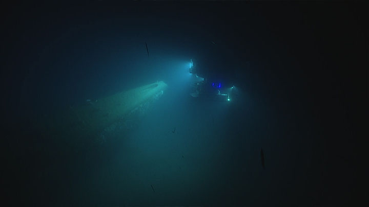
June 13 - June 27, 2021: NOAA Ocean Exploration conducted a shakedown of its dual-body remotely operated vehicles (ROVs) Deep Discoverer and Seirios on NOAA Ship Okeanos Explorer in the Atlantic Ocean between Norfolk, Virginia, and Newport, Rhode Island. The expedition included engineering test dives in water depths up to approximately 5,000 meters (3.1 miles). ROV dives were conducted during the day with overnight mapping operations.
Read more
From May 14-27, 2021, NOAA Ocean Exploration will lead the 2021 Technology Demonstration on NOAA Ship Okeanos Explorer from Cape Canaveral, Florida, to Norfolk, Virginia.
Read more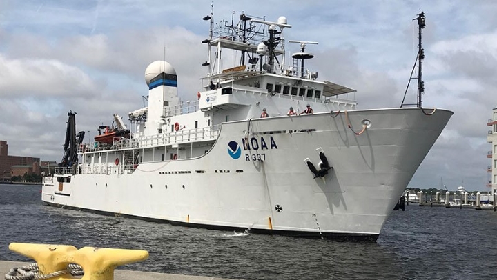
From July 18 to August 1, 2019, NOAA and partners will conduct a telepresence-enabled expedition on NOAA Ship Okeanos Explorer to demonstrate, test, and evaluate five emerging and existing technologies for possible integration into NOAA operations.
Read more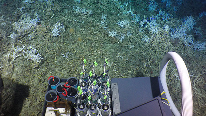
From August 19 to September 2, 2018, NOAA and partners at the Bureau of Ocean Energy Management and the U.S. Geological Survey conducted a research expedition on the Woods Hole Oceanographic Institution-operated R/V Atlantis to collect critical baseline information about deepwater habitats offshore the U.S. Mid- and South Atlantic.
Read more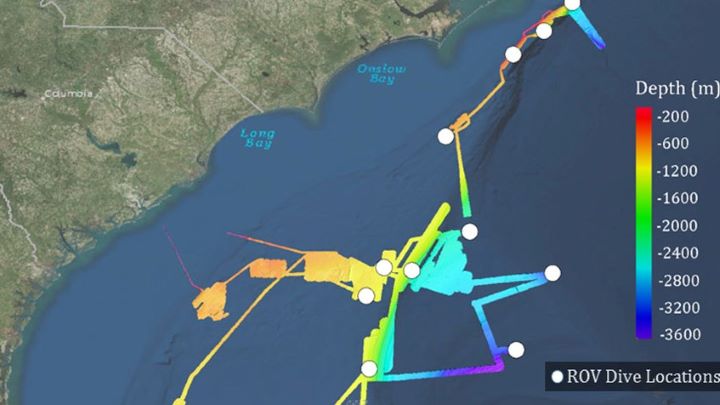
From May 22 through July 2, 2018, NOAA and partners conducted a two-part, telepresence-enabled ocean exploration expedition on NOAA Ship Okeanos Explorer to collect critical baseline information about unknown and poorly understood deepwater areas of the Southeastern United States.
Read more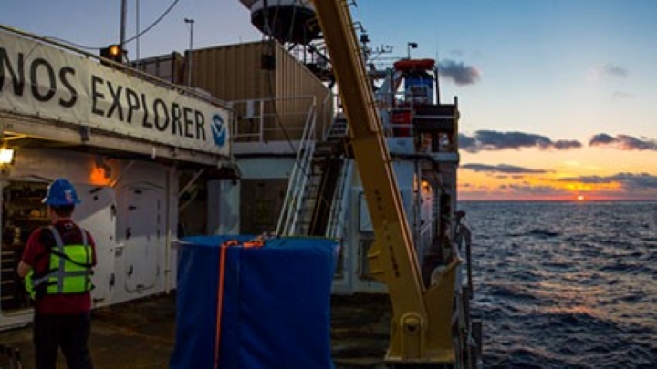
From July 18 to August 1, 2019, NOAA and partners will conduct a telepresence-enabled expedition on NOAA Ship Okeanos Explorer to demonstrate, test, and evaluate five emerging and existing technologies for possible integration into NOAA operations.
Read more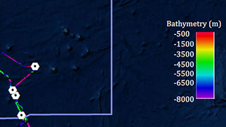
From March 7 – 29, 2017, NOAA and partners conducted a telepresence-enabled ocean exploration expedition on NOAA Ship Okeanos Explorer to collect critical baseline information about unknown and poorly known deepwater areas in the Howland and Baker Unit of the Pacific Remote Islands Marine National Monument, now known as Pacific Islands Heritage Marine National Monument and the Phoenix Islands Protected Area.
Read more
The 2016 Deepwater Exploration of the Marianas expedition was a 59-day, three leg telepresence-enabled expedition including remotely operated vehicle, CTD rosette, and mapping operations to explore unknown and poorly known areas in and around the Marianas Trench Marine National Monument and the Commonwealth of the Northern Mariana Islands.
Read moreThe above items are only a selection of the educational materials highlighting underwater robots on our website.
View More