2023 EXPRESS: Exploration of Central California Coast (AUV and Mapping)
(EX2308)
October 21 - November 10, 2023
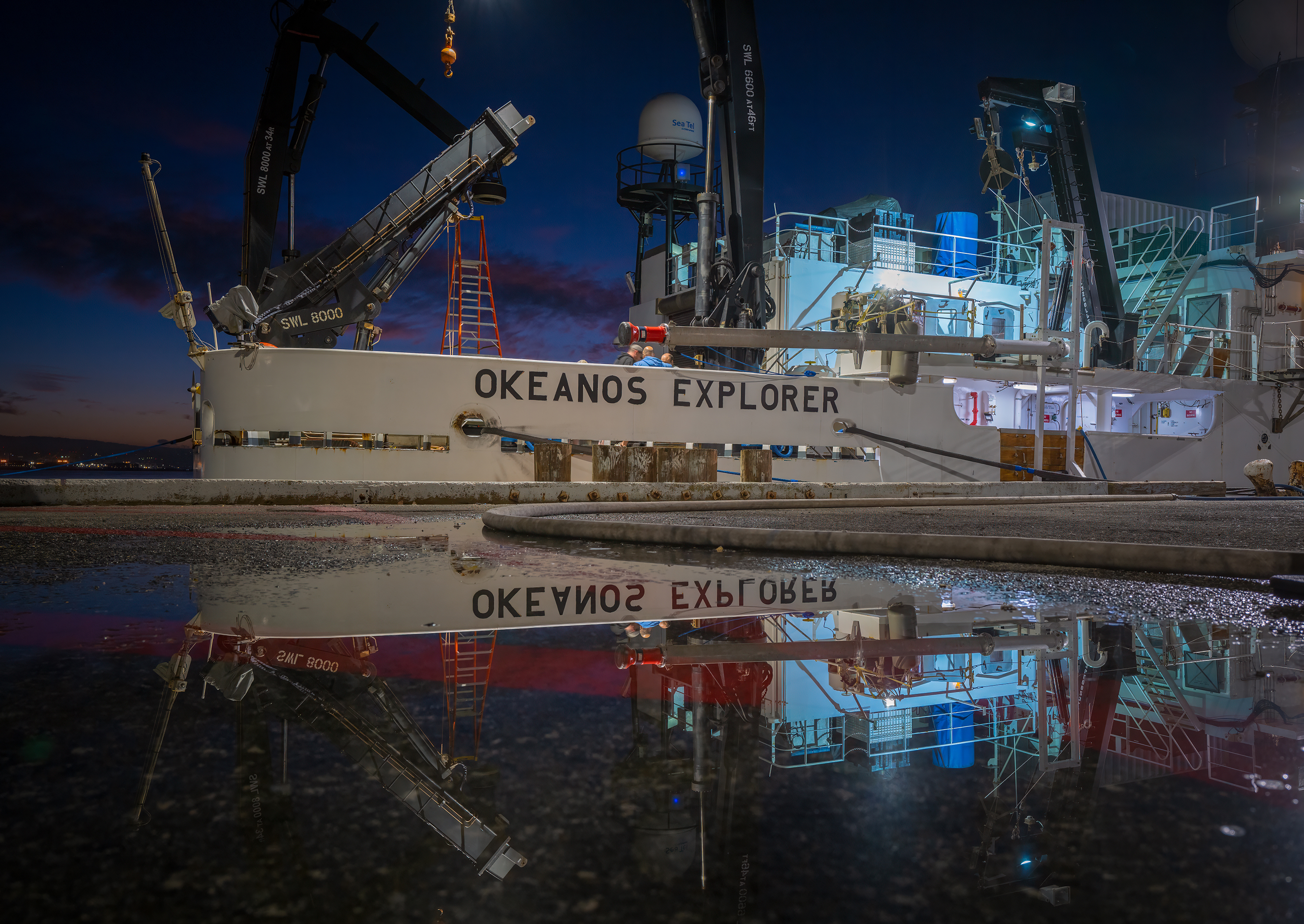
NOAA Ship Okeanos Explorer
Central Coast of California; Proposed Chumash Heritage National Marine Sanctuary
Test autonomous underwater vehicle operations and learn more about the biology and geology of the proposed Chumash Heritage National Marine Sanctuary.
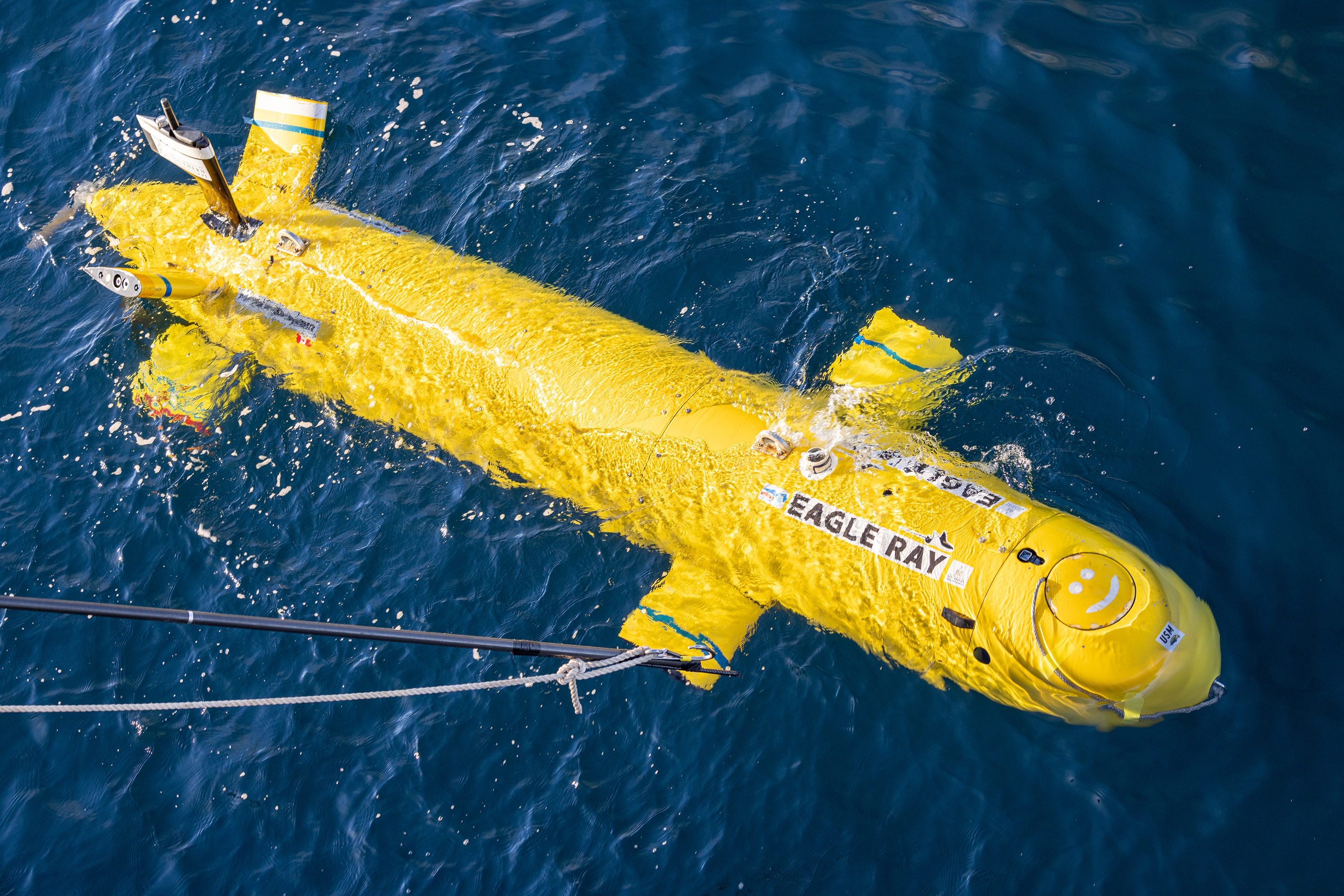
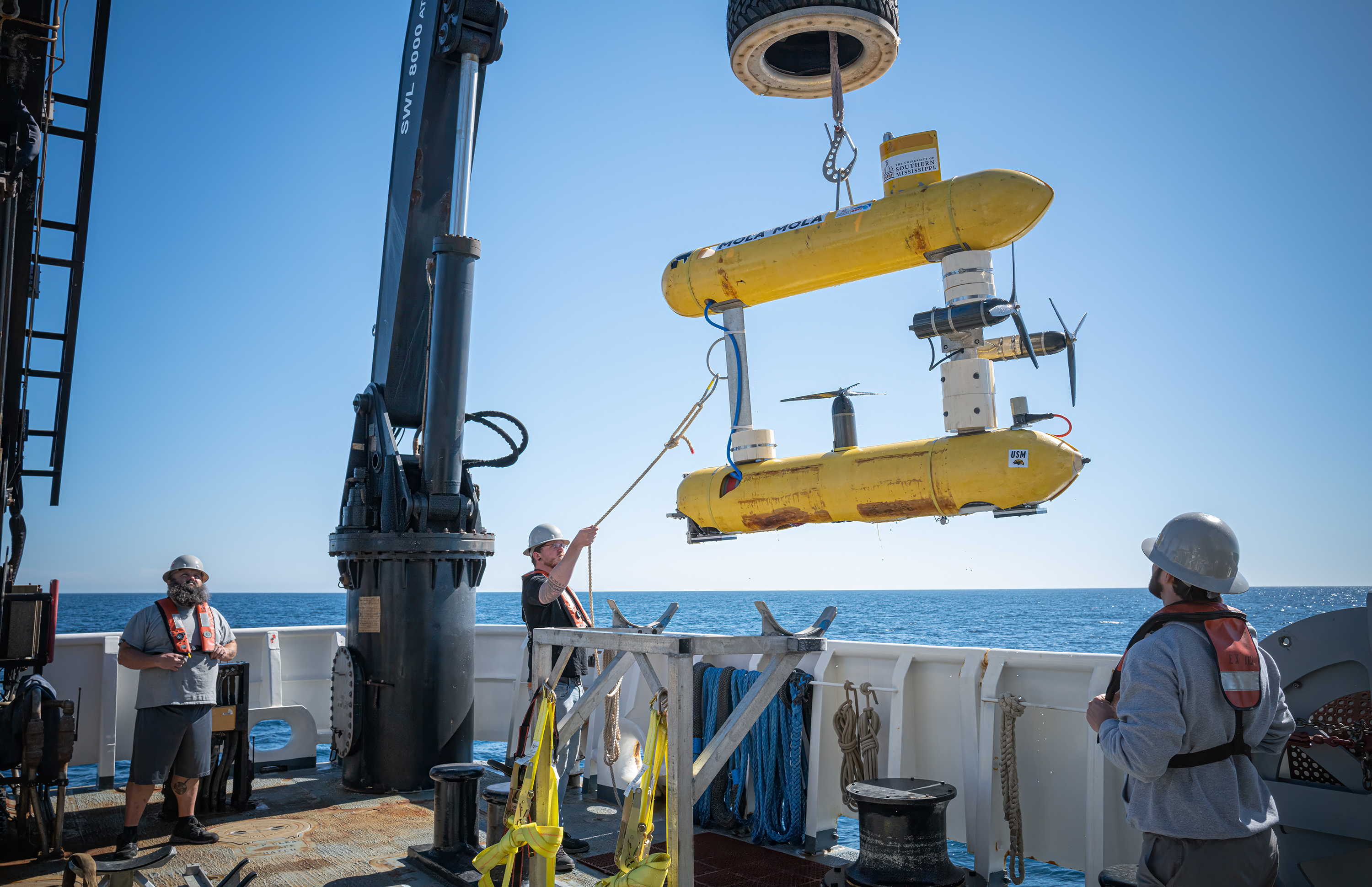
Autonomous underwater vehicles Eagle Ray and Mola Mola
Expedition Summary
To speed up the pace of ocean exploration, NOAA Ocean Exploration is committed to technological innovation and expansion of our own capacity to explore. As such, one of the primary goals of this expedition was to test autonomous underwater vehicle (AUV) operations to better understand how we might incorporate AUVs into and augment standard operations on NOAA Ship Okeanos Explorer.
During the 2023 EXPRESS: Exploration of Central California Coast expedition, NOAA Ocean Exploration and partners tested autonomous underwater vehicle operations as part of an effort to learn more about the biology and geology of the region. Video courtesy of NOAA Ocean Exploration, 2023 EXPRESS: Exploration of Central California Coast. Download largest version (mp4, 214 MB)
AUVs offer a unique ability to collect seafloor data over large areas from just above the seafloor, allowing for the collection of higher resolution data than is possible from surface-based platforms. In partnership with the NOAA Ocean Exploration Cooperative Institute (OECI), we tested two AUVs owned and operated by the University of Southern Mississippi. This was the first time these AUVs were used on Okeanos Explorer.
- Eagle Ray, a traditional mapping AUV, is equipped with a multibeam sonar and sub-bottom profiler to collect high-resolution seafloor and water column mapping data.
- Mola Mola, a photo survey AUV, is equipped with powerful cameras and a laser to capture seafloor imagery and complementary mapping data.
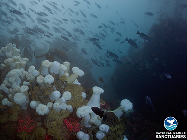
Another goal of this expedition was to learn more about the biology and geology of the proposed Chumash Heritage National Marine Sanctuary — an area of national importance — for priority science and management purposes. To identify targets for this exploratory work, NOAA Ocean Exploration collaborated with NOAA's Office of National Marine Sanctuaries, Channel Islands National Marine Sanctuary, and local tribal members.
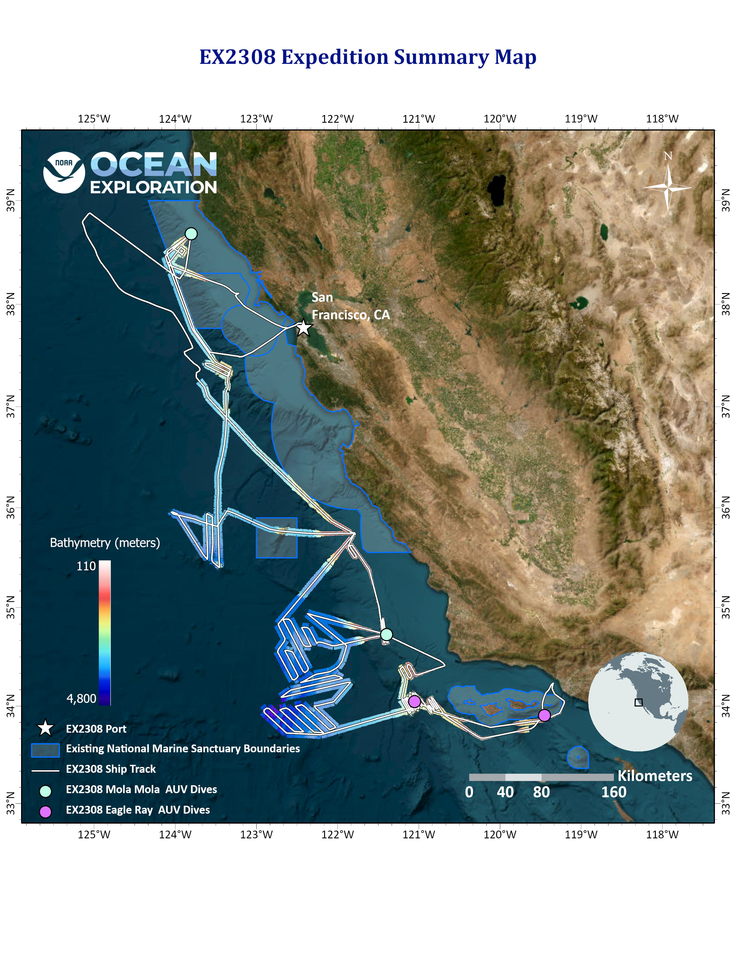
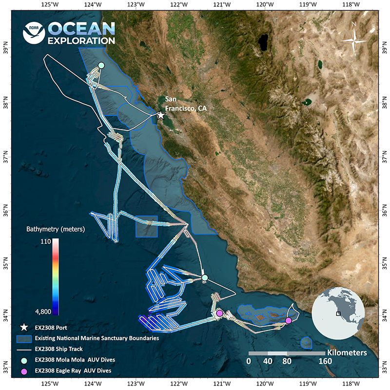
During the expedition, the team mapped approximately 22,259 square kilometers (8,594 square miles)/3,697 linear kilometers (2,297 linear miles ) of seafloor using the shipboard mapping systems and executed five complete dives (two with Eagle Ray, three with Mola Mola) on a variety of seafloor features. The depths of these dives ranged from approximately 400 meters (¼ mile) to 2,000 meters (1.2 miles). Highlights include:
- Mapping data collected with Eagle Ray's sub-bottom profiler of a sponge reef within Channel Islands National Marine Sanctuary, which supplemented ship-based data collected during the EXPRESS: West Coast Mapping 2022 expedition.
- Mapping data collected with Eagle Ray's sub-bottom profiler of Rodriguez Seamount: These data revealed numerous interesting geological features at the base of the seamount, including faults, and were collected during the vehicle's deepest dive to date, almost 2,000 meters (1.2 miles).
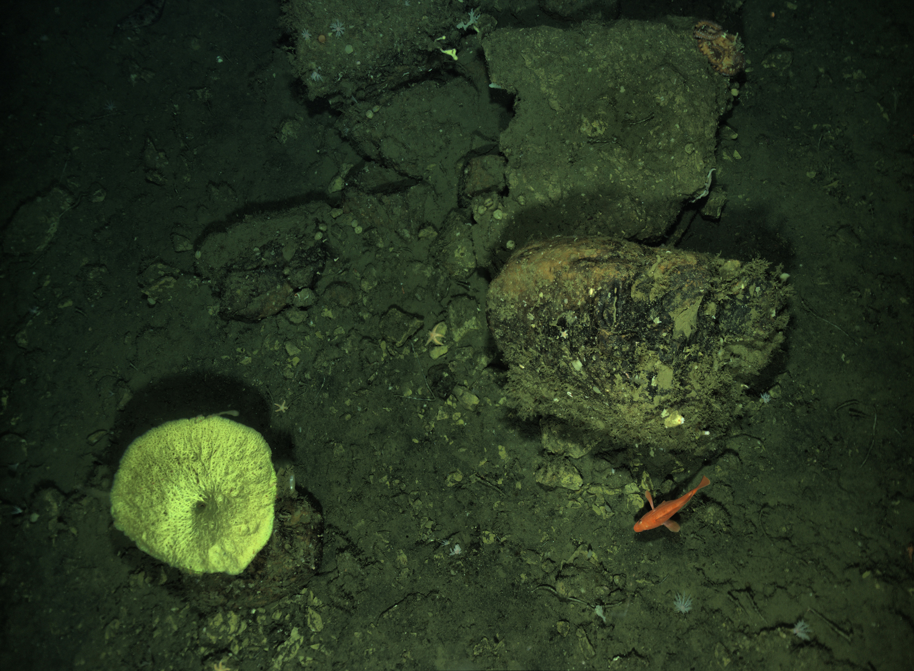
- Imagery captured by Mola Mola in a priority area of Greater Farallones National Marine Sanctuary: Nearly 9,000 highly detailed images (maximum resolution of approximately 3-5 millimeters) were collected in the survey area (60 x 60 meters, 197 x 197 feet). The team is putting these images together in a mosaic that will provide a landscape view of the survey area's biology and geology and enable an accurate biological assessment of the life within it.
- Insights into AUV operations, such as AUV deck operations during launch and recovery and data management, that will inform how we can efficiently use AUVs during future expeditions.
To further efforts to protect our ocean by uniting traditional ecological knowledge and Western science, NOAA Ocean Exploration invited two members of the Coastal Band of the Chumash Nation, Mia Lopez and her daughter Keli, to join the expedition team aboard Okeanos Explorer to share their knowledge, traditions, and connections to the ocean and learn about ocean exploration operations first hand. Through a series of livestreamed events, Mia conducted five land acknowledgements to honor California coastal tribes, the traditional stewards of the waters we explored. Mia and Sam Cuellar, the expedition coordinator, also participated in a live interaction as part of a community outreach event hosted by Channel Islands National Marine Sanctuary and NOAA Ocean Exploration at the Cabrillo High School Aquarium in Lompoc, California.
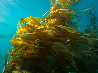
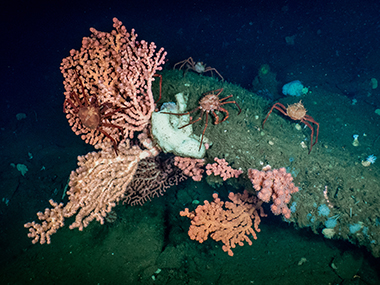
Image and Video Highlights
Exploration Team

Sam Cuellar
Expedition Coordinator
Leonardo Macelloni
Autonomous Underwater Vehicle Team Lead
Marco D'Emidio
Autonomous Underwater Vehicle Team Lead
Andy O'Brien
Technical Team LeadEducation Content
Education theme pages provide the best of what the NOAA Ocean Exploration website has to offer to support educators in the classroom during this expedition. Each theme page includes expedition features, lessons, multimedia, career information, and associated past expeditions.
NOAA's Office of National Marine Sanctuaries and the individual sanctuaries also provide education resources for teachers and students.


Related Links
- EXpanding Pacific Research and Exploration of Submerged Systems (EXPRESS)
- NOAA Ship Okeanos Explorer: 2023 Expeditions Overview
- NOAA Ship Okeanos Explorer
- Okeanos Explorer — Live Operations Map
- Autonomous Underwater Vehicles: Eagle Ray and Mola Mola
- Mapping Tools: Sonar | Sub-bottom Profiler
- Proposed Chumash Heritage National Marine Sanctuary
- Chumash Heritage
Partners
- NOAA Ocean Exploration Cooperative Institute
- University of Southern Mississippi School of Ocean Science and Engineering
- Channel Islands National Marine Sanctuary
- NOAA Office of National Marine Sanctuaries West Coast Regional Office
- NOAA Office of National Marine Sanctuaries
- Northern Chumash Tribal Council
Media Contacts
Emily Crum
Communication Specialist
NOAA Ocean Exploration
ocean-explore-comms@noaa.gov
Keeley Belva
Public Affairs Officer
NOAA Office of Marine and Aviation Operations
keeley.belva@noaa.gov
Sarah Marquis
West Coast/Pacific Media Coordinator
NOAA Office of National Marine Sanctuaries
sarah.marquis@noaa.gov
Shauna Fry
Outreach Coordinator
Channel Islands National Marine Sanctuary
shauna.fry@noaa.gov
For more information about EXPRESS, visit the EXPRESS Media Resources page.
NOAA Ocean Exploration’s 2023 EXPRESS: Exploration of Central California Coast (AUV and Mapping) expedition will contribute to the National Strategy for Exploring, Mapping, and Characterizing the United States Exclusive Economic Zone, Seabed 2030, the interagency EXpanding Pacific Research and Exploration of Submerged Systems (EXPRESS) campaign, and the America the Beautiful initiative.
Data collected during all expeditions will be available in NOAA's public data archives within 120 days of its completion and will be accessible via the NOAA Ocean Exploration Data Atlas.
Published October 18, 2023
Last updated March 7, 2024