


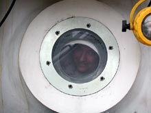
Rich Styles, the author of this log entry, peers out of a porthole in the aft chamber of the Johnson-Sea-Link II submersible. Click image for larger view.
Some Oceanographic Arithmetic
August 16, 2003
Rich Styles
Department of Geological Sciences
University of South Carolina
People are terrestrial beings. We are at home on land in almost any climate and have developed all types of technology to protect us from the elements. This, combined with our curiosity, has driven us to every mountain, desert, forest, jungle, and frozen tundra imaginable. These accomplishments ignite the imagination, but remind us that very little of the terrestrial landscape has escaped human contact. With so much of the dry Earth’s secrets unveiled, what unique exploration opportunities await future generations? To answer this question, I decided to apply a little inductive reasoning based on our experience during this mission.
What follows is a thought experiment involving a “back of the envelope” calculation. The term “back of the envelope” symbolizes a scientific method in which a person scribbles a few numbers on the back of an envelope, or some other piece of paper, to determine if their conceptual model or theory provides a reasonable explanation of some phenomenon in the face of actual physical data. In this case, I am trying to determine how long it would take to visibly survey the entire ocean floor and to determine if this is a practical exercise given the limits of modern-day technology.
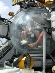
Dave Wyanski of the South Carolina Department of Natural Resources prepares for another deep dive in the JSL II sphere. Click image for larger view.
This exploration of the Charleston Bump encompasses a small region off the South Carolina and Georgia coasts. Its intent is to visually survey the sea floor of the Charleston Bump and to collect and document the diversity of benthic (bottom-dwelling) organisms. Twice a day, a team of four explorers (two scientists and two crew members) enter a small submersible and dive to the bottom. During the next 2 to 3 hrs, they travel a relatively narrow path hovering within site of the ocean floor. The bottom of the ocean is dark, and the powerful sub lights can only illuminate a region about 10 m across. If the sub travels 1 km during the mission, then the total area surveyed is about 0.01 sq km. This is equivalent to about two football fields. The surface area of the world’s ocean floor is nearly 361 million sq km. If a hundred similar missions are carried out annually, it would take 1.8 million yrs to visibly survey every spot on the ocean floor. This is a very long time, and attests to the fact that we know very little about our water planet. (Can you perform a back-of-the-envelope calculation and come up with this number, or at least something close? What if only 10 missions were carried out annually?)
In sum, our expedition is unique, and each day, our science team and crew members become the first to explore a small portion of our planet previously untouched by human interventions. But don’t fret -- the numbers speak for themselves. The vast ocean will provide future generations with almost limitless opportunities to be the first to explore and document new and as yet unimaginable frontiers.
Answer to back of the envelope calculation:
OK, during one mission, the sub surveys an area of 0.01km2. Counting 2 dives per day times 100 missions a year gives a coverage area of 2 km2 per year. Dividing the total area of the ocean by this number gives the time it would take to survey the entire ocean without repeats.
Sign up for the Ocean Explorer E-mail Update List.